
In June and July 2022, I spent five weeks riding and exploring Armenia’s backcountry and trails, entering from Georgia in the north-east, heading south down the eastern side of the country to the Iranian border, before making my way back up to Yerevan on the western side.
In this guide, I’ve tidied up and summarised the routes I took into 8 sections for anyone who is considering a trip there. By and large these routes are good for mid-weight and lightweight dual-sport bikes with decent 50/50 tyres and similarly equipped 4x4s, though the latter should proceed with more caution than the former.
From the muddy mountains of the country’s north-eastern Tavush and Lori regions to the searing heat along the border with Iran, Armenia is an explorer’s delight. The country is slightly sleepier but no less beautiful and the people no less welcoming then its slightly more brash, northern neighbour, Georgia.
A word of caution: Armenia does not have a great relationship with its eastern neighbour, Azerbaijan, and there are still flare-ups between the two countries following the 2020 Nagorno-Karabakh war. Make sure you note the below comments on this, and follow security advice both from your own government, the local authorities on the ground and the advice of any other travellers you might meet en route.
You can download the GPX files here and if you want to learn more about what you’ll find on the way, then read on below….
1. Sadakhlo to Aghavnavank


In three words: Canyons, monasteries and mud.
Total distance & est. duration: 314km, 3-4 days.
Surface: Mixture of tarmac but mostly muddy (in June) dirt tracks when off-asphalt. There are some decent dirt roads/pistes in places.
Summary
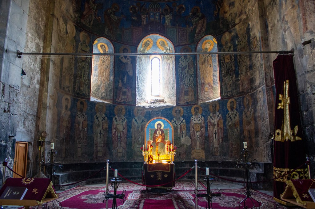
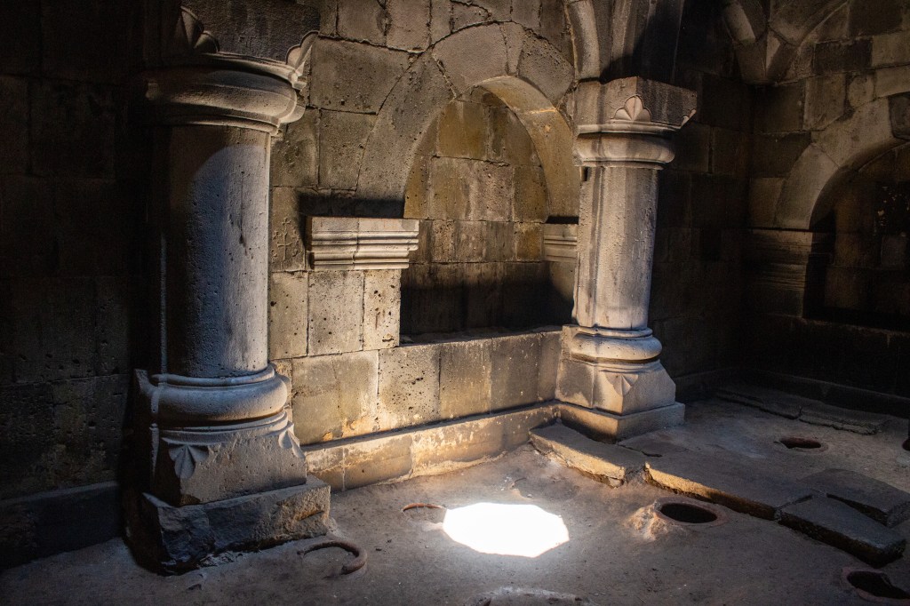
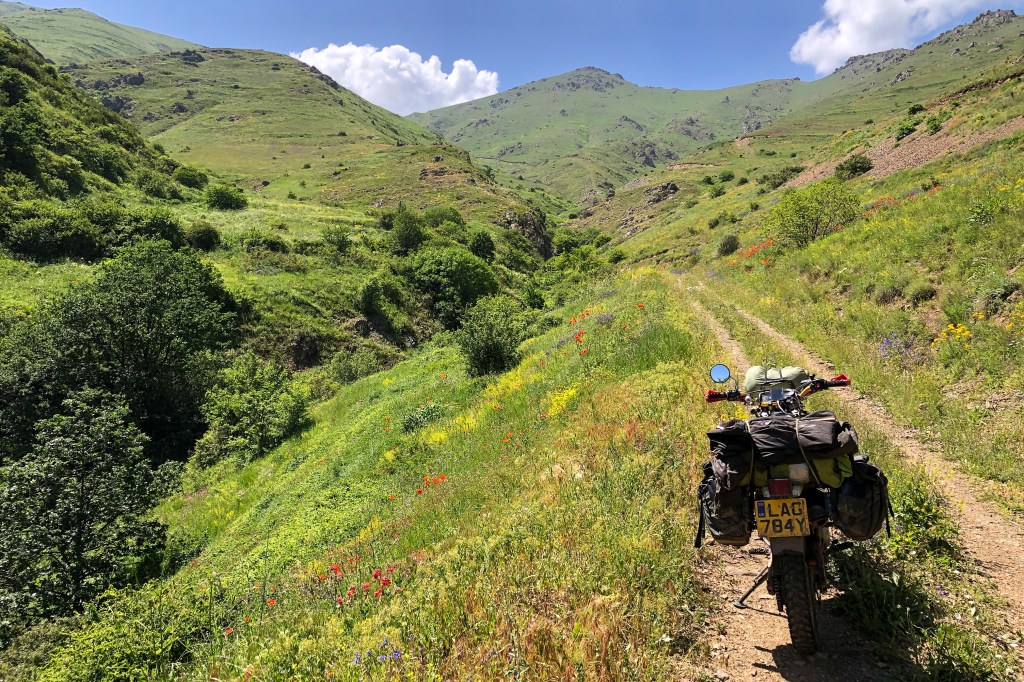
Starting from an excellent wild camp spot in the fields bordering the Georgian frontier, this route snakes through the Gugark mountains of Armenia’s north-east Tavush Province via the Debed Canyon with the UNESCO heritage-listed monasteries of Haghpat and Sanahin, along with the old copper-smelting town of Alaverdi, with its huge (now disused) industrial complexes and the Kobayr monastery outside of Tumanyan, which (as of summer 2022) is gradually being restored.
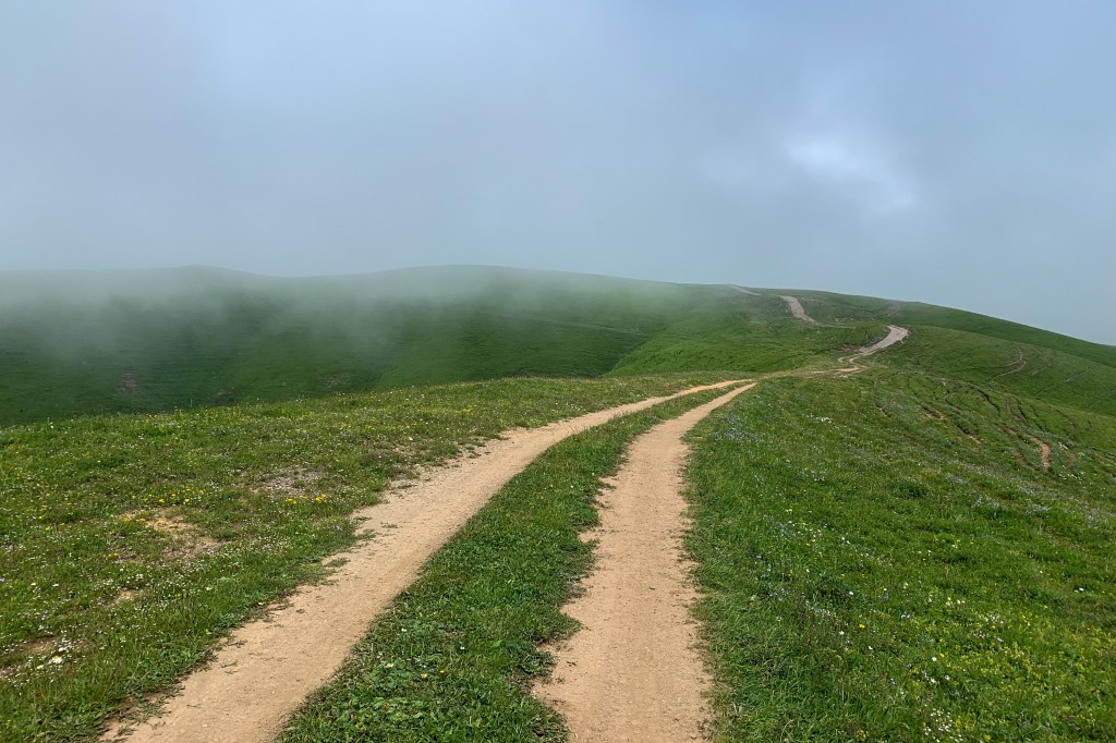
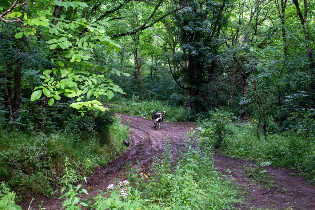
There’s then a plethora of dirt-tracks and pistes/unpaved roads that you can use to cut east over the heavily forested and sometime misty mountains towards the Azeri border, to find the hidden and derelict Arakelots and Kirants monasteries; trail conditions may vary, but just follow your nose and you’ll find a way through.
From there, the route continues south via Ijevan, finishing at the Aghavnavank monastery. Dilijan, the ‘Switzerland of Armenia’, and Lake Sevan beckons beyond.
Logistics
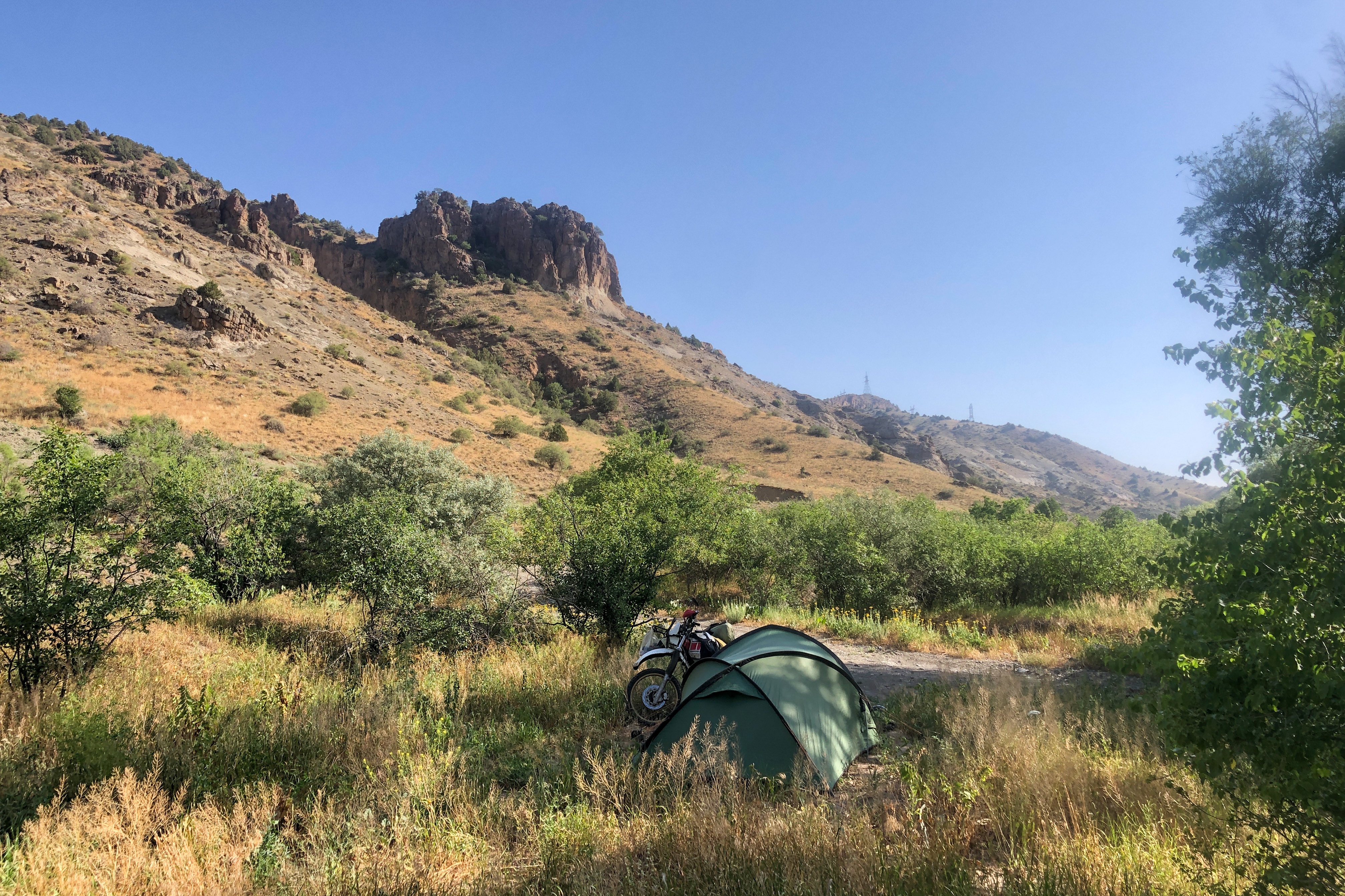
Aside from the starting point camping spot, there are three other great spots – one organised/formal site just down from Haghpat at Kanchaqar Camping (41.089528, 44.705781), a wild site atop of the eastern side of the Debed Canyon, just outside of Akner (41.08499, 44.68186) and another good wild spot (40.91909, 45.13038), albeit down a rough stone track, just outside Ijevan.
If you’re travelling this route in the spring (including and up to late June) make sure you’re riding with a decent set of tires (50/50 at least, and no, Heidenau K60’s won’t cut the mustard!) and waterproofs for the off-road sections through the mountains. The weather at this time of year is pretty warm but the rain can be heavy, prolonged and frequent. The thick mud that leaves some serious ruts on the network of tracks. On the route to the Arakelots and Kirants monasteries in particular, be prepared for some big splashes on the way after wet weather, with a couple of river crossings chucked in for good measure.
Ensure you’re stocked up on petrol and food before leaving the tarmac as, is often the case in this part of the world, fuel and food stops can be few and far between, and usually only in the main towns/villages. To the east, the route runs close to the border with Azerbaijan – check the latest security situation before hitting the road; whilst it has historically been more settled than it is to the south, there were attacks from the Azeri side of the border in this region in autumn 2022.

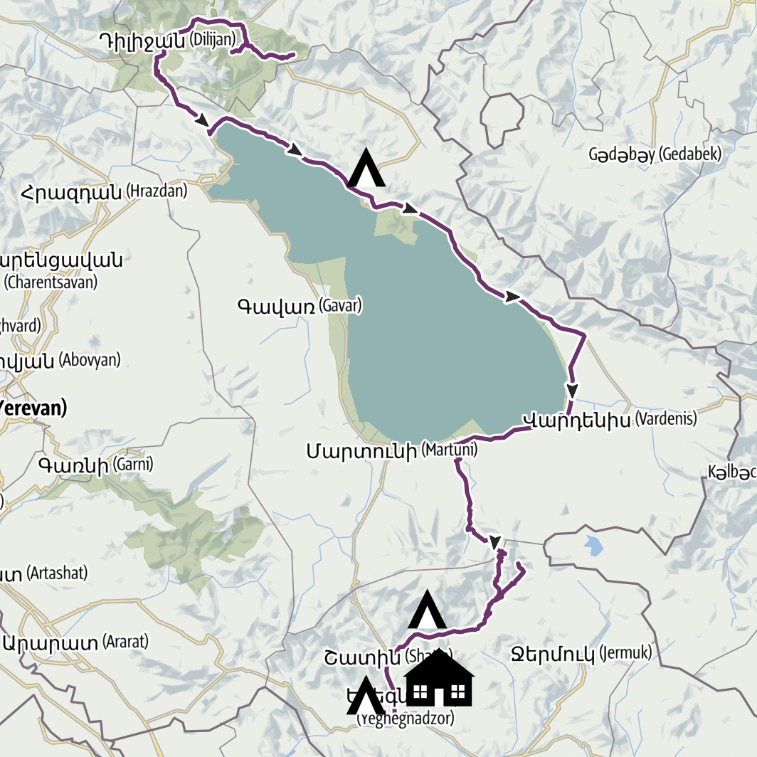
2. Aghavnavank to Yeghegnadzor


In three words: Lake Sevan, the Vardenis Ridge and the world’s most unpronounceable town name…
Total distance & est. duration: 268km, 2-3 days.
Surface: Tarmac, decent dirt tracks, dusty mountain tracks.
Summary
Kicking off from the monastery at Aghavnavank, itself in the Dilijan National Park and the green mountains of southern Tavush, the trail cuts back west on tarmac, keeping on the black top through Dilijan, before heading south through the pass to Lake Sevan beyond.
You may want to be more creative with your route than I had time to, at this point – there are a large number of mapped dirt trails on OSM to the east of this route; a route starting at Khachhardzan which follows the eponymous river through the mountains of Dilijan National Park before rejoining the main road at Tsovagyugh, looks like one with particular promise.
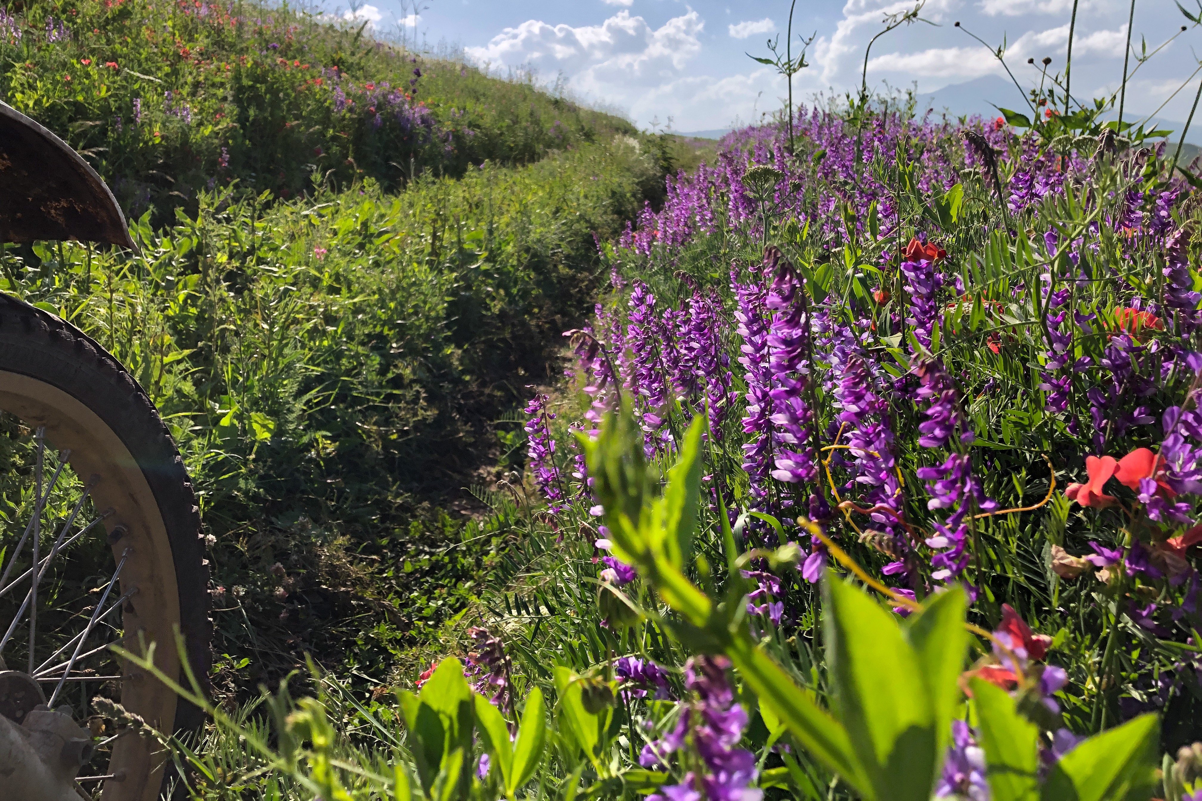
Heading south along the eastern shore of Lake Sevan, the route heads off the tarmac to cut through the lavender fields that border the Lake around Geghamsar, before finally turning south-proper and heading towards the Vardenis Mountains at Vardenik.
From here, things start to get really interesting and anytime before high summer (July and August) I’d recommend that you work on the basis that you may need to turn back at any point. You’ll work your way to the Vardenis Ridge via a series of high alpine pastures and finally up the pass via a winding dirt road that has a few smaller, but potentially quite deep river crossings in places – you’ll need to be careful in the spring-time/ early summer months, as flow can be fast from these and the beds can be rocky The pass too can be blocked with ice and snow well into late June.
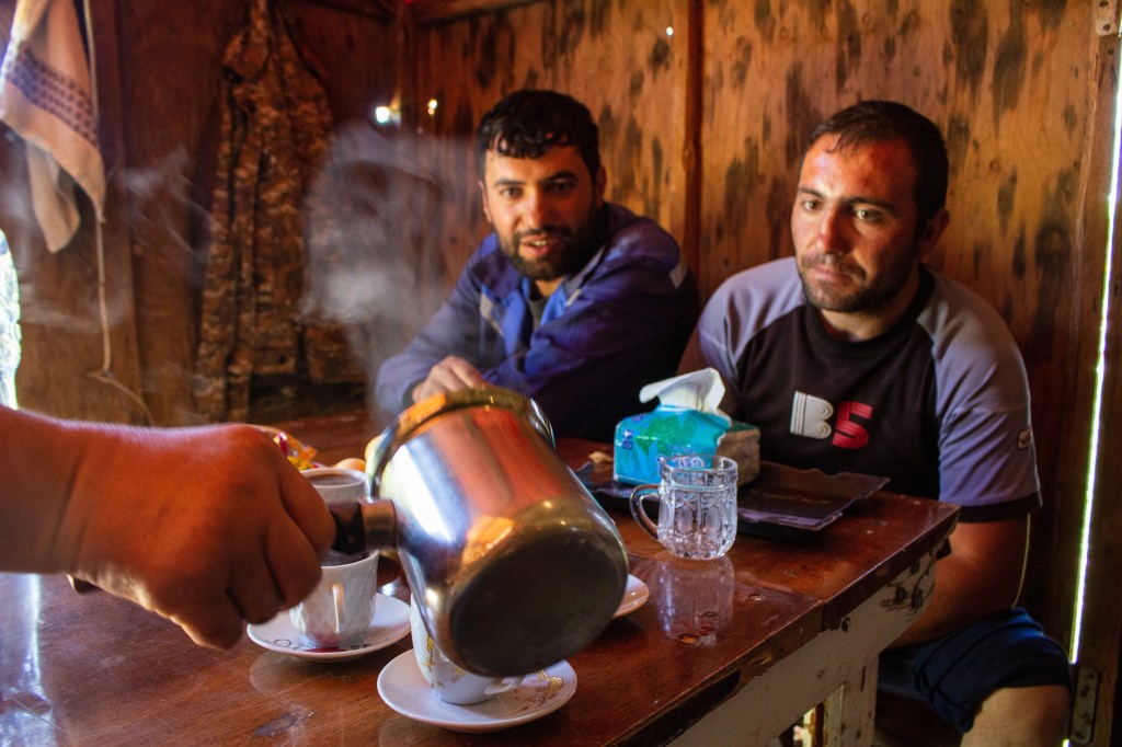
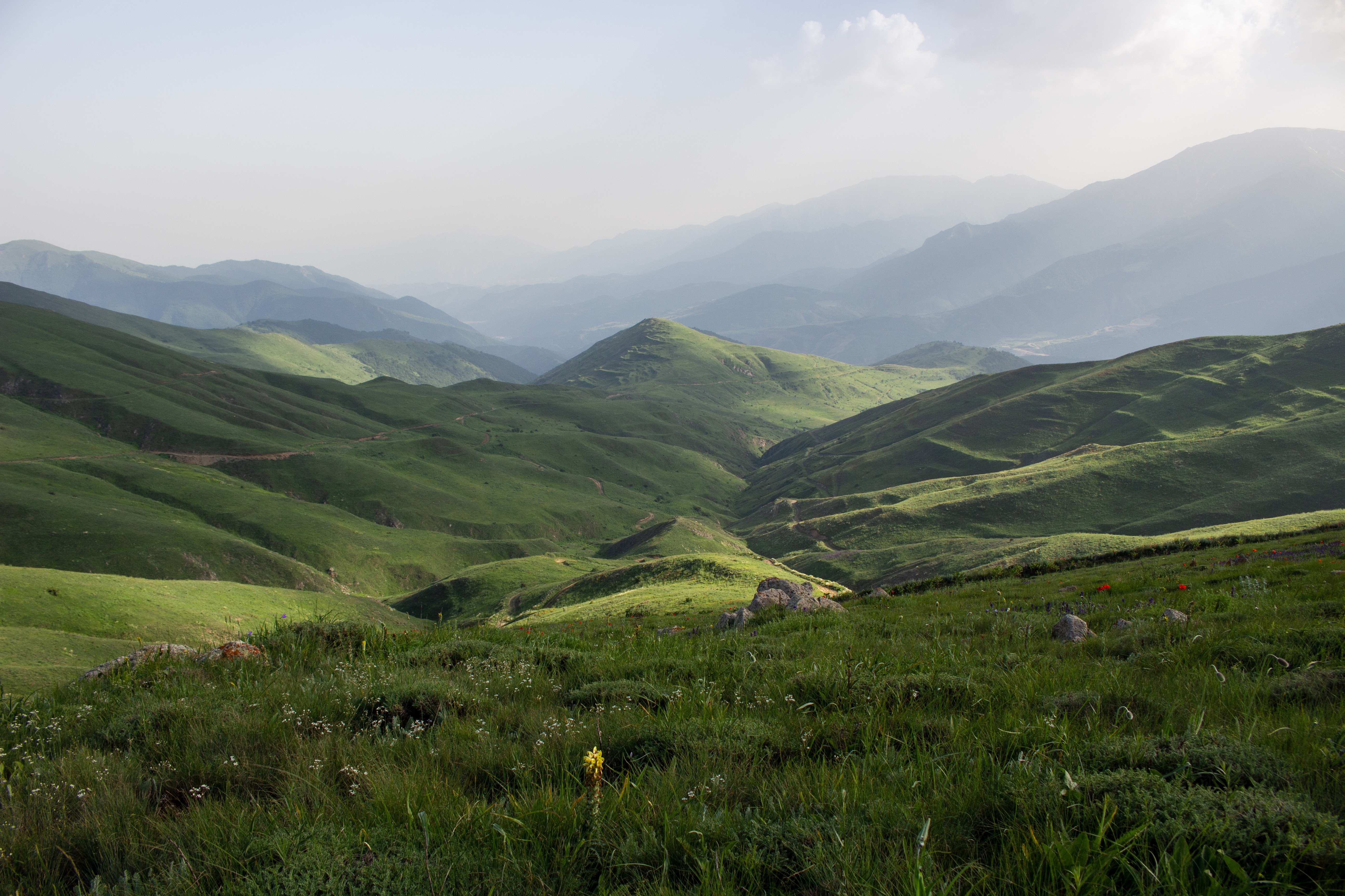
Once through the pass, you’ll come down the other side onto more grazing pastures and a series of villages, where shepherds set up their camp for the summer. Stop and chat to them and you’ll more than likely be welcomed inside for coffee! For the more adventurous followers, there’s a there-and-back spur from the route from Getivanq which will take you back into the mountains on a good quality dirt track that eventually becomes more challenging until it runs out, with a few river crossings that can be tricky, and carpets of wild flowers.
In the Yeghegi valley beyond, there are ruined monasteries (this is Armenia, after all…) at Arates, Hermon and Tsakhats Kar, along with waterfalls at Goghtanik.
From north of Yeghegis, out of Horbategh village, there are a series of tracks running back north into the mountain that could be worth exploring with a potential route through back to the main road. Back on the main road, it meets the main north-south route just after Shatin, with a quick run south down to Yeghegnadzor; if you’re hungry, then there’s a kebab stop at the crossroads just outside of the town, near the Cross Ways Campsite
Logistics
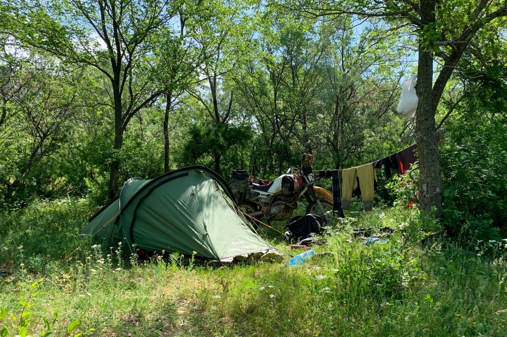
The eastern shore of Lake Sevan is littered with excellent wild camping spots just down from the main road; just be aware that you’re still at 1,900m, so it can get windy and cold well into mid-June, when I scouted this route. There’s plenty of cover from the vegetation if you’re a bit savvy and of course water supplies for washing and cooking are good. The place I found (40.5525422, 45.1997082) was spot on.
On the other side of the Vardenis mountains, are also organised campsites at Yegheghis and at Yehegnazador, at Crossway Campsite – I didn’t visit either, however, so I can’t vouch for them.
Yeghegnadzor is the regional capital, and is well served in terms of mechanics, shops and guesthouses. I found myself stranded here for a week while my bike was impounded, and stayed at the excellent Apricot B&B in the north of the town (39.771983, 45.332554), where there’s off street parking, a homely stay and the owner’s daughter Jemma speaks good English (note: the Booking.com location is incorrect). The town is still only a couple of hours from Yerevan if you want to stock up on anything major before heading into the more remote south.
3. Yeghegnadzor to Tatev


In three words: Tarmac, hills, mushrooms….
Total distance & est. duration: 235km, 1 day.
Surface: Mainly tarmac, with some trail work
Summary
For the more adventurous, it’s worth noting that this segment probably has the most tarmac and is one of the less exciting routes posted as part of this guide. Note that there are some good trail routes off this road covered in the later routes on this page (see Vorotnavaq to Yeghegnadzor and Meghri to Vorotnavaq, below).
It’s a long ride south on the main north-south route across central Armenia, initially cutting through the mountains south of Yeghegnadzor, past Vayk down over Vorotan Pass and then onto the rolling flatlands to the south. Nonetheless, it’s a nice, chilled ride, the kind where you plug in your headphones, load up your Spotify and let the miles pass you by.
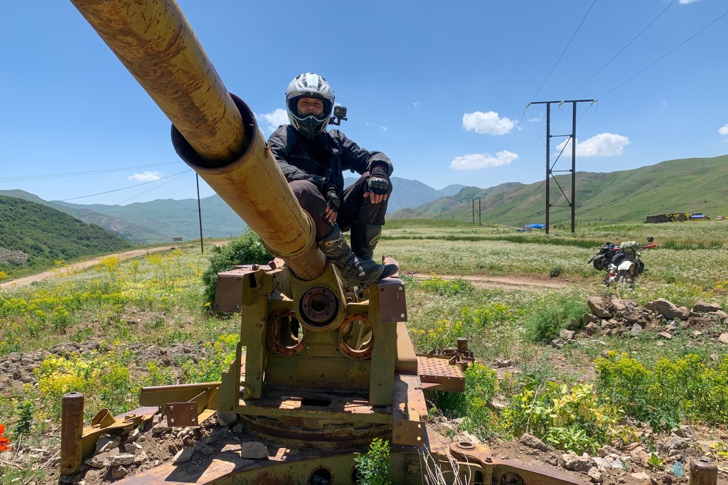
In quieter, more peaceful times, this route will take you on to the Armenian enclave of Nagorno-Karabakh, via Gori and over the Azerbaijani border. However the crossing was closed in summer 2022 as a peace agreement between the two sides had yet to be agreed following the 2020 war. The farmtracks of the borderlands on the Armenian side are still worth exploring – think rolling pasture and fields of brightly coloured wildflowers on a scale like you’ve more than likely not seen before. Just be careful – you’ll probably come across the odd Armenian Army unit camping out, this close to the border. Be sensible about using your camera or flying drones. If you like mushrooms, this is your place – locals in Ladas of every colour line the main roads selling them in small buckets.
This is also the first place, headed south, that you’re likely to come into contact with Russian Army peacekeepers and you’ll see more and more traffic headed north from Iran, including red ‘Mack’ trucks, imported to the country from the US before the 1979 revolution and still running, seemingly providing the backbone of road freight travelling through Armenia and beyond.
The route ends at the iconic Tatev Monastery, though if you’ve followed the above routes by this point and seen your fair share of monasteries, you’ll find that its setting over and the ride through the Vorotan Gorge on the way there is the real star of the show here.
Logistics
Petrol stops can be a bit few and far between on this stretch, and be mindful that even some of those advertised on Google Maps are in fact only LPG/diesel only stops. Vayk is your last decent town after you leave Yeghegnadzor, until you reach Gori. Gori is a good sized town with plentiful accommodation, general supplies and anything else you might want to pick-up, though I wouldn’t recommend the accommodation I stayed at in the town, sadly.
At Tatev, there’s a couple of campsites right by the monastery, at the Tatev Info Cafe (39.380623, 46.248017), where you can get some good grub but also at the property immediately next door (39.381002, 46.247624). I stayed at the latter as it was a bit cheaper, flatter and a bit better protected from the noise of the road.

4. Tatev to Meghri


In three words: Hot, hilly & very beautiful
Total distance & est. duration: 238km, 2 days
Surface: Tarmac, dirt tracks (some rutted & overgrown), gravel tracks.
Summary
From Tatev, the route first strikes out east deep into the mountains and deeply wooded mountains via trails and gravel roads, where you can find yourself monastery-bagging again. You need to be a bit careful with security – you’ll eventually join Highway 2 southbound, which hugs the border with Azerbaijan very closely, with the roadside crash barriers marking the border itself in places; you can literally peer down at Azeri-flagged guard posts below.
Kapan is the last major town before you reach Meghri, further to the south. For a bit more of a challenging ride with some fantastic views, there’s a 10-15km rough and muddy track (but still navigable by 4×4 as well as dual-sport motorbike) to an open/free campsite just to the east of Mount Khustup, offering great views of Kapan and the Voghji valley below. There’s no through-route south that I could find, so it’s a case of returning back down Kapan and then west on the hardtop along the Voghji valley, with stop offs at the Halidzor Fortress and Vahanavank Monastery before reaching the Meghri Pass.
Here’s where the riding starts to get a little more interesting again; there’s a southbound dirt loop from the crossroads at the top of the Pass, which runs to the west of Highway 2. It’ll take you through overgrown farm tracks that hug the side of the mountains, before descending down into lower pastures and making the odd river crossing or two, before rejoining the main road. Then it’s back north to the pass on the black top and a second dirt route cutting high up through the mountains with some fantastic views, travelling south-east. Once again, the tracks may be overgrown with steep drops, so there’s a need for caution. This will eventually bring you to Highway 17, riding the black top all the way to the Iranian border and Meghri.
Logistics
You’ll more than likely encounter Russian Army peacekeeping checkpoints, so have your passport handy and be prepared to be flexible in your plans and route, particularly around Kapan and Arevik National Park. Make sure you’re clear on where you’ve come from, if asked (you will be), that you haven’t somehow snuck across the border from Azerbaijan, and where you are going. Showing your GPX track can help with that, but it’s worth checking that beforehand – sometimes it might show that you’ve strayed across the frontier even if you’re sure that you haven’t. Be particularly careful on Highway 2 the north east of Kapan and Highway 17 to the east/south-east; unless you’re turned back before you get to those points, that is.
The Nafcha Campsite to the east of Mount Khustup (39.14351, 46.36953) is a favourite with groups travelling from Yerevan – it’s a natural starting point for the hike up the mountain. Even in late June, it can get foggy and rainy up there too. Its free and there aren’t any facilities, other than a trough with a fresh water supply suitable for cooking – which you’ll have to share with the cattle! But the view is definitely worth it.
In Meghri, Haer B&B (38.909079, 46.239648) is a lovely place to stay, slightly out of town to the north. There’s plenty of room for parking motorbikes and bicycles, plus a car or two as well. Food is excellent and the rooms are big and well furnished; it’s a good rest stop for a day or two before getting ready to start heading north.

5. Meghri to Vorotnavanq


In three words: Abandoned villages, landslides, wildflowers
Total distance & est. duration: 226km, 2 days
Surface: Tarmac, dirt tracks, gravel tracks.
Summary
It’s headed north now and back over the Meghri Pass on the hard top, all the way just past the town Kalajan. Then there’s the first of two ‘back and forth’ routes, probing high into the mountains immediately to the north of the town; the map shows that there is/used to be a route through, down to the Geghi valley beyond, but today there’s the vague semblance of a route that that’s been either wiped out by the construction of a gas pipeline or a landslip. Still, the ride up and back is well worth it, on open rolling hills and pasture that steadily gets steeper, giving some epic views around.
There’s a second, longer, more rewarding back and forth trip just after. This can be accessed easily via the Geghi valley having taken the diversion around on the main road, which will gradually become a decent gravel and then an OK rock/dirt track. You’ll need to ford a few times as the route criss-crosses the river but in mid/late June the height was fine. The route takes you through a small u-shaped valley, over a few fords, past the abandoned villages Karut and Kitsk, with fantastic greenery and fields of wildflowers. Once again, however, landslides end your route, but it’s well worth the effort.
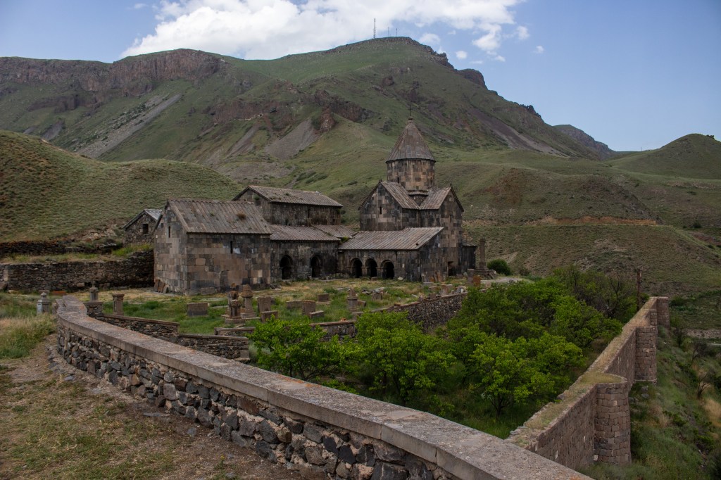
Back north past Kapan again, the route cuts off the main highway, over the top of the hills and then onto the light dirt tracks and trails that wind their way for miles through the farmland, past crumbling ancient caravanserai and shepherds, eventually joining the Vorotan valley at the eponymous town and its famous monastery at Vorotnavanq, with its picturesque setting overlooking the gorge below.
Logistics
Kalajan is a good pitstop for food supplies, petrol and other bits and bobs.
For campsites on the two back and forth ‘excursions’ there are plenty of great looking wild camp spots. If you camp on the second of the two routes, then there are plenty of places by the track on the way to Karut and Kitsk. With the river, there’s a good water source for cooking and washing; there may be the odd car passing by during the night but they will probably just pass on by. I didn’t camp at the monastery at Vorotnavanq, but there’s plenty of space for a tent and it seemed suitably quiet if you wish to do so.

6. Vorotnavanq to Yeghegnadzor


In three words: Dams, gorges, snakes
Total distance & est. duration: 177km, 1-1.5 days
Surface: Farm tracks, muddy tracks, tarmac, gravel tracks, broken up roads
Summary
Striking out north once again from Vorotnavanq, the tarmac provides an enjoyable scenic route until you reach the main town in this part of the world, Sisian, which is a good place to pick up various supplies and fuel.
Thereafter, the route dives off the main road and onto farm tracks again, shadowing Highway 2 through ramshackle villages. At Tsghuk, it cuts south-west, to work its way around the Spandaryn Reservoir via spooky abandoned villages and buildings. There’s a brief back and forth excursion down the very pretty gorge at the foot of the dam; if you’re thinking of camping here, note the signs about snakes!
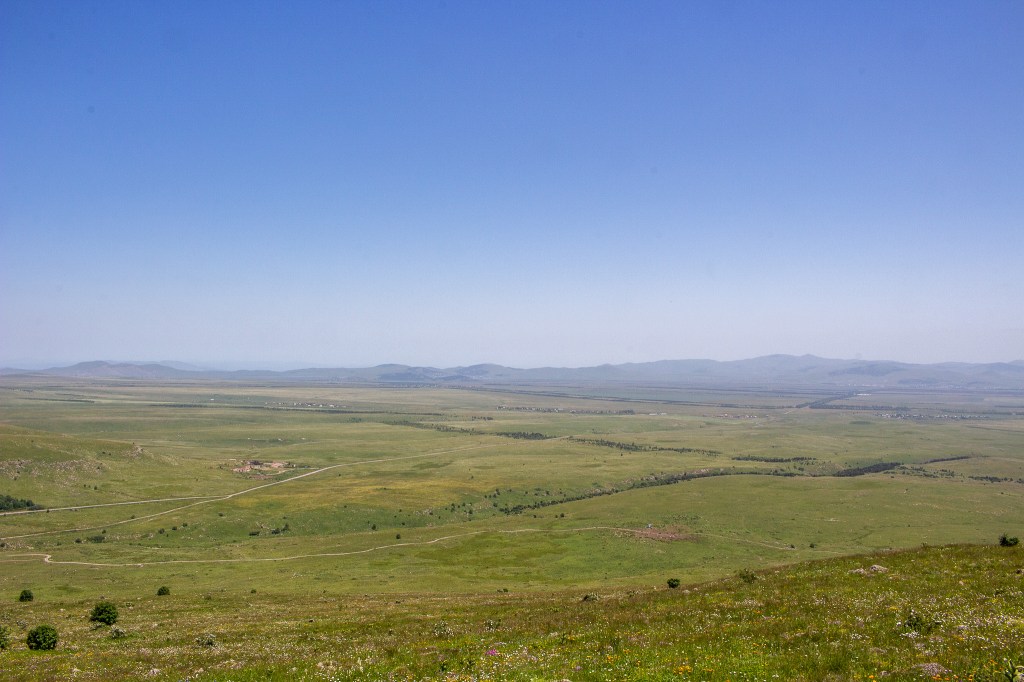
Back out of the gorge, it’s a long and (in June) muddy ride across rolling grasslands to the west of the reservoir with panoramic views ahead, tracking the eastern border of Nakhchivan, an Azeri enclave some 5km to the west, before rejoining Highway 2 at Gorayk. Don’t miss this section – it’s well worth it.
After a stint on the black top and up and back over over the Vorotan Pass, the route swings in a north-easterly direction on to the Old Jemuk Highway, a narrow, beaten up old Soviet road, which has fallen into disrepair. It tracks the Arpa River through the Gndevank Canyon and finally onto Jermuk via the Kechkut Reservoir. Jermuk is a once famous Soviet-era spa town which sadly looks like its seen much better days. The Gndevank Monastery en route is well worth a stop-in; it’s a peaceful place to relax amongst the well-watered and manicured gardens. Beware of rockfalls on this route – it can be blocked by large boulders, stones and fallen scree.
It’s a ‘there and back’ route for Jemuk, to/from Highway 2, but there are some attractive looking trails on the map through the backcountry from Jemuk back to Yeghegnadzor, headed in a parabola in a south-westerly direction; at least one other motorcyclist I met in the latter had found a route through this way. Alternatively you can take the main, modern tarmac road from Jemuk back to Highway 2, which runs parallel to the Old Jermuk Highway.
Logistics
Sisian has all the usual things you’d expect from a decent sized local town, in terms of petrol and food/supermarkets. There’s a few cafes and decent restaurants around too, as well as the odd army surplus store, which is useful for picking up additional camping supplies etc.
There’s are lots of potential camping spots around Spandaryn Reservoir too; you’ll just need to exercise a degree of caution given the dam and the proximity to the border with Nakhchivan.
On the banks of the Arpa, 5-10 mins ride up the Old Jermuk Highway from Highway 2, there’s an excellent camping spot (39.70221, 45.56348), with the Arpa offering an excellent supply of water for cooking and a swim to escape the heat.
There are other spots too as you head towards Jemuk, on the banks of the Kechkut Reservoir, where there are numerous picnic shelters, some of which have running water supplies.

7. Yeghegnadzor to Yerevan


In three words: Monasteries, golden hills, monasteries (!)
Total distance & est. duration: 177km, 1 day
Surface: Tarmac, gravel roads, dirt trails, farm tracks
Summary
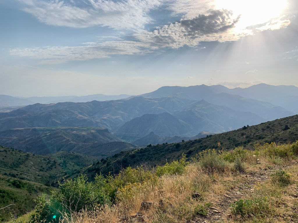
The first part of this route is probably the most exciting, a loop out of Yeghegnadzor, initially with an excursion on the decent minor roads through the golden grassy rolling hills to the monastery at Tanahat. Then it retraces its steps to take you back to the outskirts of Yeghegnadzor and then into the bigger hills to the north-west, looking back towards the Vardenis Mountains. It’s an enjoyable route on light dirt tracks to the monastery at Spitakavor and then over the top to come out in the Yeghegis valley and on to the main north-south Highway 10 at Shatin. If you get the chance to do this loop in late summer afternoon sun, take it – the whole area is bathed in a golden light.
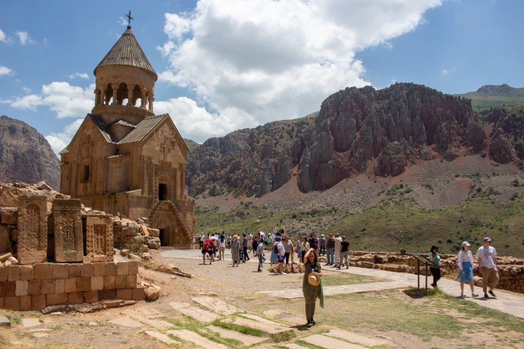
From there, it’s black-top all the way to Yerevan, but not before a final in/out excursion to the famous Noravank Monastery; if you’ve had previous monasteries largely to yourself, be prepared for the hordes at this site! If you’ve got time, it’s probably worth checking out some of the trails marked on the map in the surrounding area.
Logistics
See ‘Aghavnavank to Yeghegnadzor’ above for information on Yeghegnadzor.

8. Yerevan to Gogovan

In three words: Food, tyres & potholes
Total distance & est. duration: 227km, 1.5 days
Surface: Tarmac, broken up old Soviet-era roads, stone tracks.
Summary
If you’ve been out in the Styx and away from big cities for a while, then modern, European-feeling Yerevan will come as a bit of a shock to the senses. A relatively fast run to Georgia, this final route will take you on the black top via the most straightforward route to Gyumri, which, with its more modern European feel and good choice of restaurants, is well worth a stop in for lunch or an overnight stay, but then on to some more interesting riding beyond.
The road – and the view – really start to get quite fun the closer you get to the border with Georgia. Somewhere around Vardaghbyur, it becomes Highway 31 and starts getting a lot rougher, with a mixture of fields of potholes from a now unmaintained ex-Soviet road, to stoney gravelly track. Be wary that it can get cold and windy the higher you climb, even in June/July time. Eventually you come to switchbacks and a great panoramic viewpoint, looking down on the Lori plain below and Tashir beyond, which is peppered with what were once ethnic Azeri villages, long since abandoned after the first conflict between Armenian and Azerbaijan kicked-off in the late ‘80s.
Given the ongoing conflict between the two countries, it seems a fitting, albeit slightly sad, way to leave the country; the border crossing with Georgia lies not much further beyond.
Logistics
Petrol stations, food and accommodation are all plentiful enough in this part of the world.
One thing that is worth noting is that because of the amount of Iranian trade going through Armenia, if you need a new set of tyres for your bike then Yerevan is a good place to get them – they’re cheap and pretty good quality, with OK wear life (my rear tyre lasted all the way back to Bulgaria, that said). Motoshop Armenia (40.150078, 44.526879 – note: the Google Maps location may be incorrect) had a good selection, were speedy and helpful too. They’re particularly responsive to messages on Google Maps. It’s worth noting that tyres can be easier to come by here compared to Tbilisi in Georgia.

If you’ve got any questions, updates or feedback….
….on this guide, I’d like to know, just drop me an e-mail. Cheers!
