
Note: You can find a summary of and GPX files for this route here.
April 2025, Morocco
“Take my card,” said the Manager of Camp El Mharech. “The next part of the piste is very difficult.”
I looked at the card, then back at him. “Difficult, how?”
“Feche, feche. Much feche, feche.”
I was slightly sceptical of the Camp owner’s claim. To start off with, whether feche feche, the patches of notoriously slippery Saharan sand that sank 4x4s and motorbikes, existed at all in Morocco was hotly debated. Some swear it does; others claim it’s either a myth cooked up by entrepreneurial guides wanting to scare people into buying their services or overexcitable newcomers to desert travel.
In any event, my mind was set. I wanted to reach the waypoint that I had marked on my map the day before, the enticingly entitled ‘The Lost City’. This was meant to be an adventure, after all. If things got too difficult or too much for me, I’d somehow find a way to simply turn around and head back.
Camp El Mharech was in an unusual and remote location – in the middle of a gorge called Foum Mharech on the Moroccan western edge of the Sahara.
It had been a blast to get there, leaving behind me the home comforts of the bivouac at Fezzou that morning.
But rather than taking the tarmac directly south, to Sidi Ali, to join the well-worn but iconic old Paris-Dakar piste that ran parallel to the Algerian border, I opted for another route; one that I hadn’t done before, one that was less well travelled.
And offered greater potential for adventure.
Planning at Riad Perlamazigh
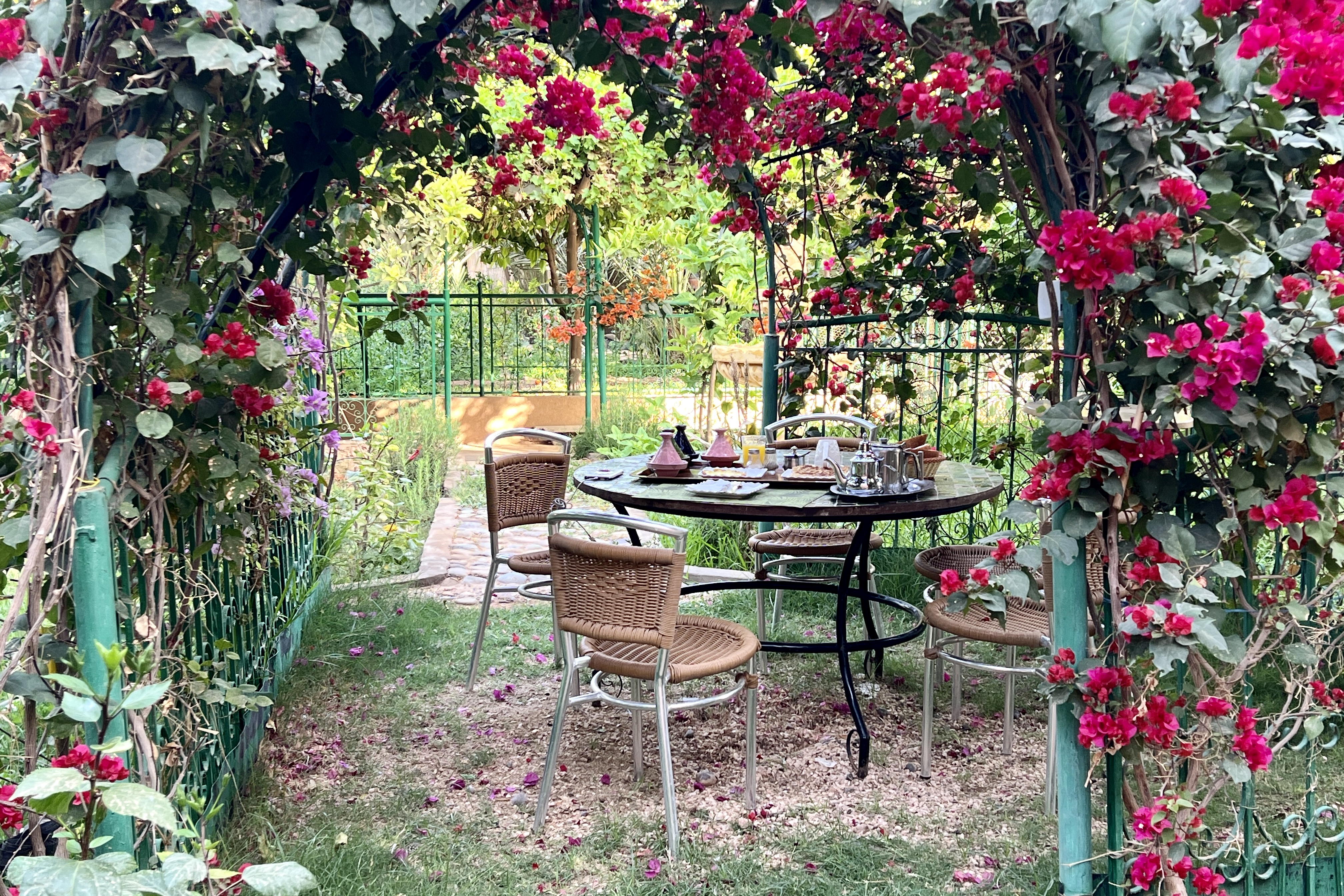
Thirty-six hours before, I had arrived at the delightful, leafy gardens of Riad Perlamazigh in the outskirts of Zagora. I was tired, hot and 3 days overdue for a shower, after spending the first week of my trip riding the High Atlas mountain sections of the Trans Morocco Trail.
For once, it had been a delight to switch off and just watch the delights of the route unfold around me, without the daily hassles of spending time researching and planning my own. But now I was ready for more of a challenge. I had another seven days to go, but I didn’t want to be rushed back to the Mediterranean coast and a ferry back to Spain.
The space on the map between Zagora and Merzouga, just to the north of the more oft-travelled pistes running closer to the Algerian border, caught my eye, with its patches of empty white spaces carved up by meandering lines of grey shaded mountains. It didn’t take much to imagine the scale of it all, the space, and most of all, having the freedom to see and explore, and watch those same meandering grey lines come to life.
When researching my own routes, I used a few sources – paper maps, satellite photos, Open Source Maps and Google Maps.
And it was on the last of these that I noticed, around two thirds into the route, a waypoint for ‘The Lost City of Ba Hallou’. That put the icing on the cake. I was sold.
Leaving Zagora
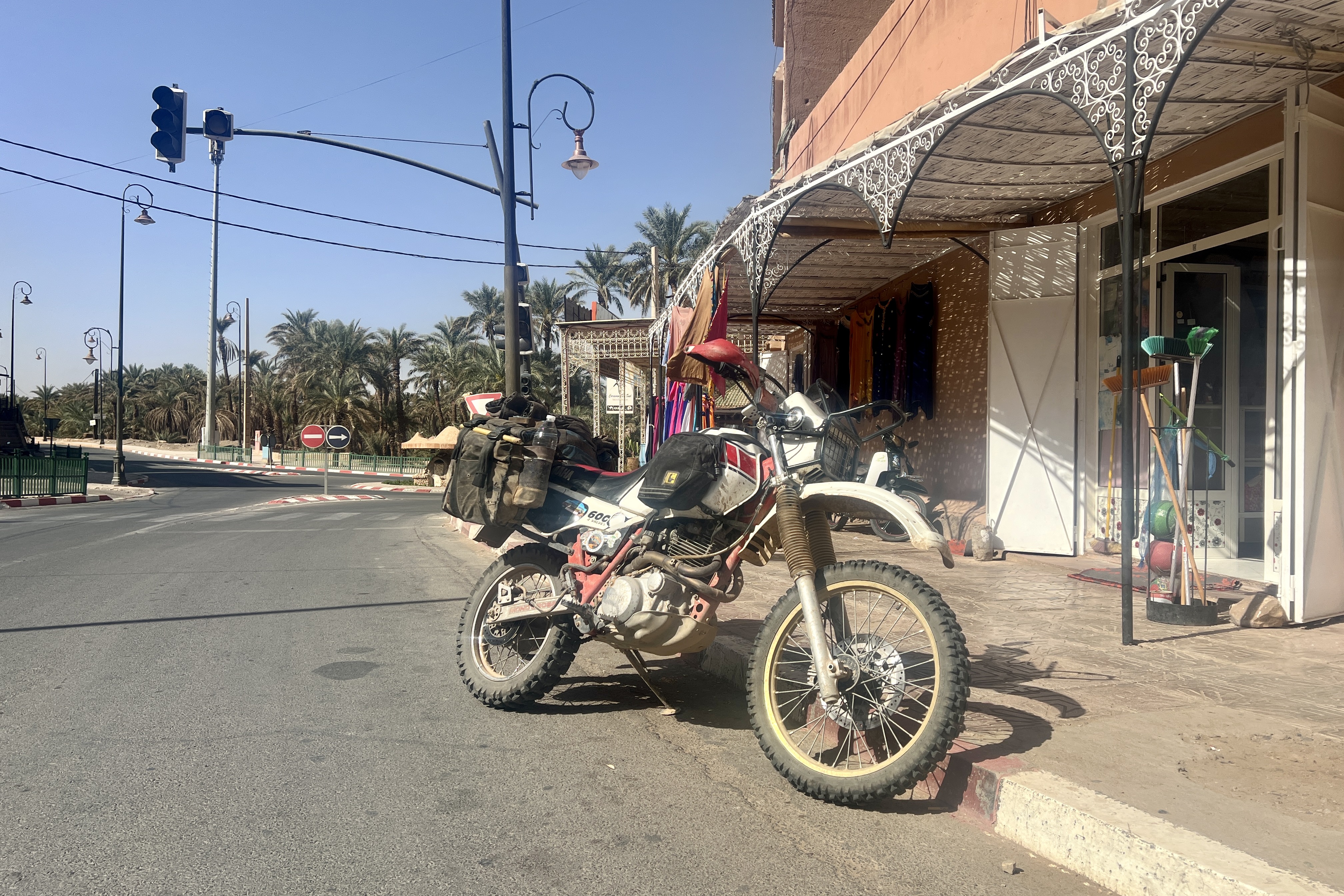
Early the next morning, I found myself in a small corner shop down the road from the hotel, stocking up on the water, food, and other essentials that would give me the autonomy I needed to do just that, giving myself a couple of days to reach Merzouga.
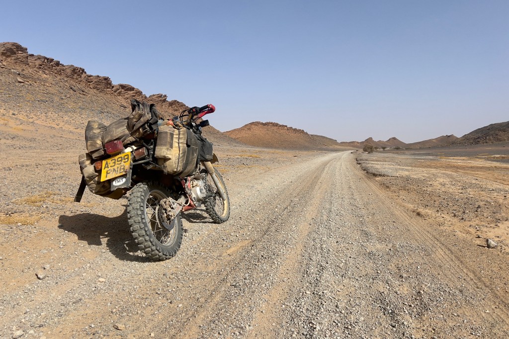
I crammed my supplies into my panniers, gave the bike one last check over for any loose straps or nuts, and headed out east from Zagora, on Route Nationale 21.
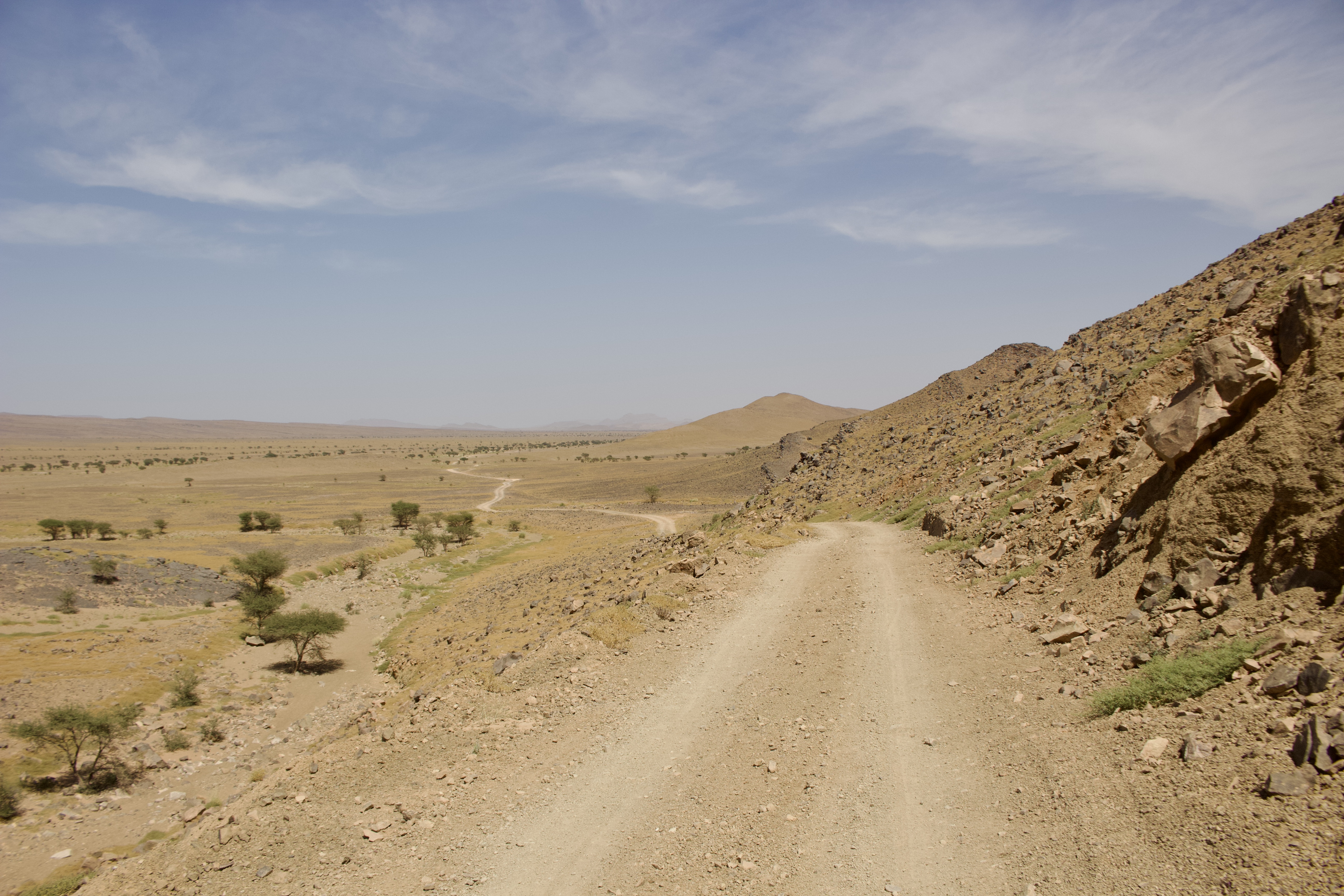
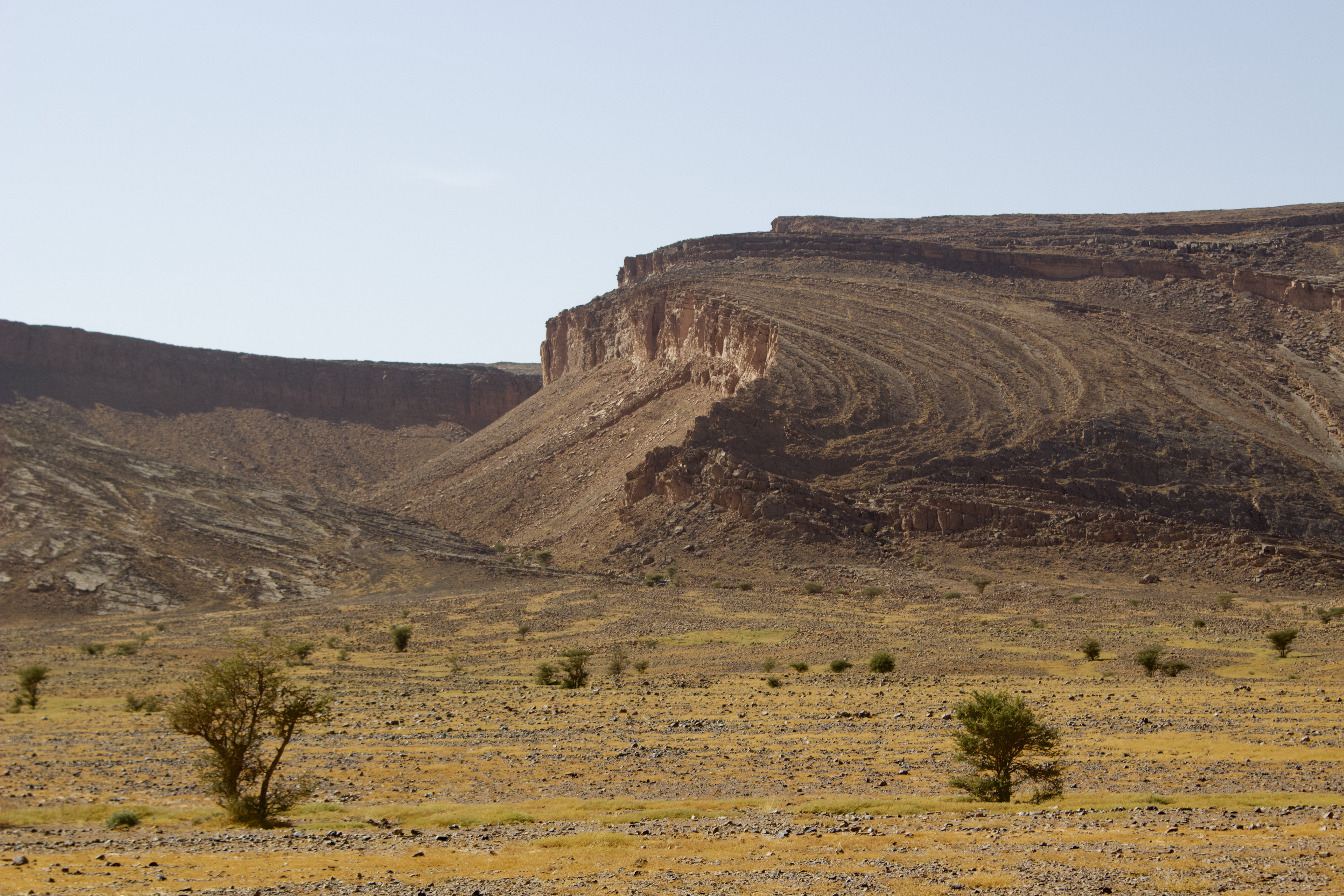
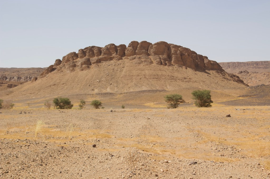
Some 30km later, I pulled off the tarmac, following a series of winding, sandy but firm farm tracks that threaded through broad valleys of desert scrub. Even from there, I could see the grey lines on the map come to life, the rocks in the form of a series of towering sentinels, with a mixture of strange folded layers and sheer cliff faces. Now I was up close, heading away from the comfort and security of the main road, into the wilderness, a small speck hurrying across the vast landscape with a plume of dust trailing far behind, its sandy brown tones contrasting against a cloudless blue sky.
After navigating a few challenging dried-up river-bed crossings and one or two patches of deeper sand, I turned east and then south-east. I passed quickly through a succession of unremarkable, flea-bitten towns, each one characterised by ugly, blocky buildings and offering little in the way of amenities. No cafés here with smiling locals sipping nous nous, watching football on TV, or setting the world to rights. Not even a small shop where I could pick up extra snacks en route. Instead, I was met only by the long, hard stares of the inhabitants, people and buildings alike battered by the strong early afternoon sirocco wind, which lent the place a distinctly Wild-West atmosphere.
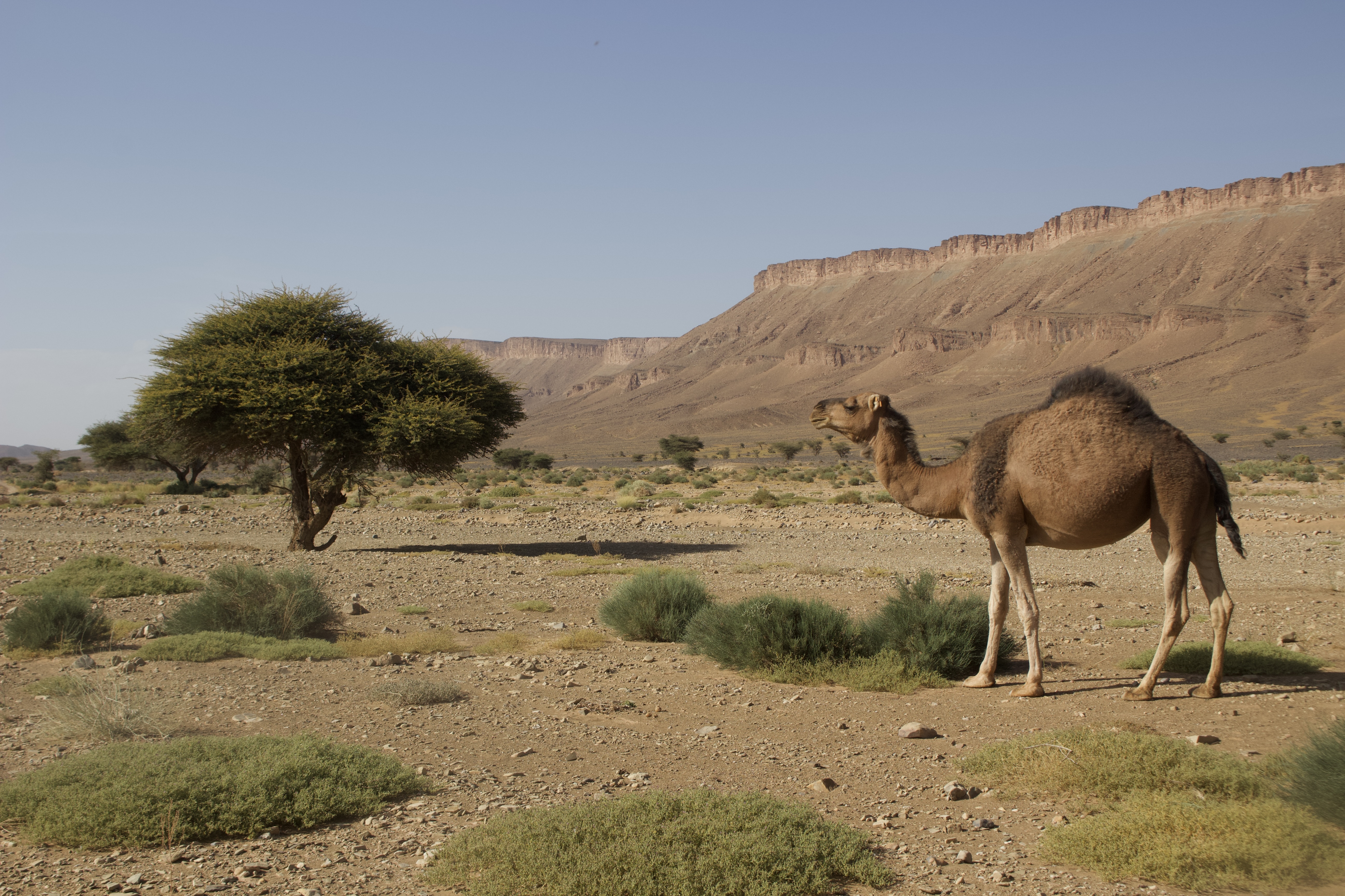
The remote scrubland surrounding the towns felt more welcoming. As the sun began its descent westwards, small clusters of green vegetation with bright yellow flowers, set against the browns of the sandy and rocky terrain began to emit a what seemed like strange, subtle glow in the slowly fading desert light, as camels rested lazily beneath acacia trees.
Eventually, I rejoined the tarmac and headed south down to Fezzou, another small town of sandy-yellow, squat buildings, but one which felt noticeably more hospitable than the ones I had just left behind. I had been prepared to camp for at least a night or two.
But upon reaching Fezzou, I succumbed to the temptation, convenience, and comfort of a bivouac at Chez Ibrahim, situated on the edge of the town, where I met Mark and Deb, a couple of Brits in a fire-red, long-wheelbase Land Rover.
Rendezvous at Camp El Mharech
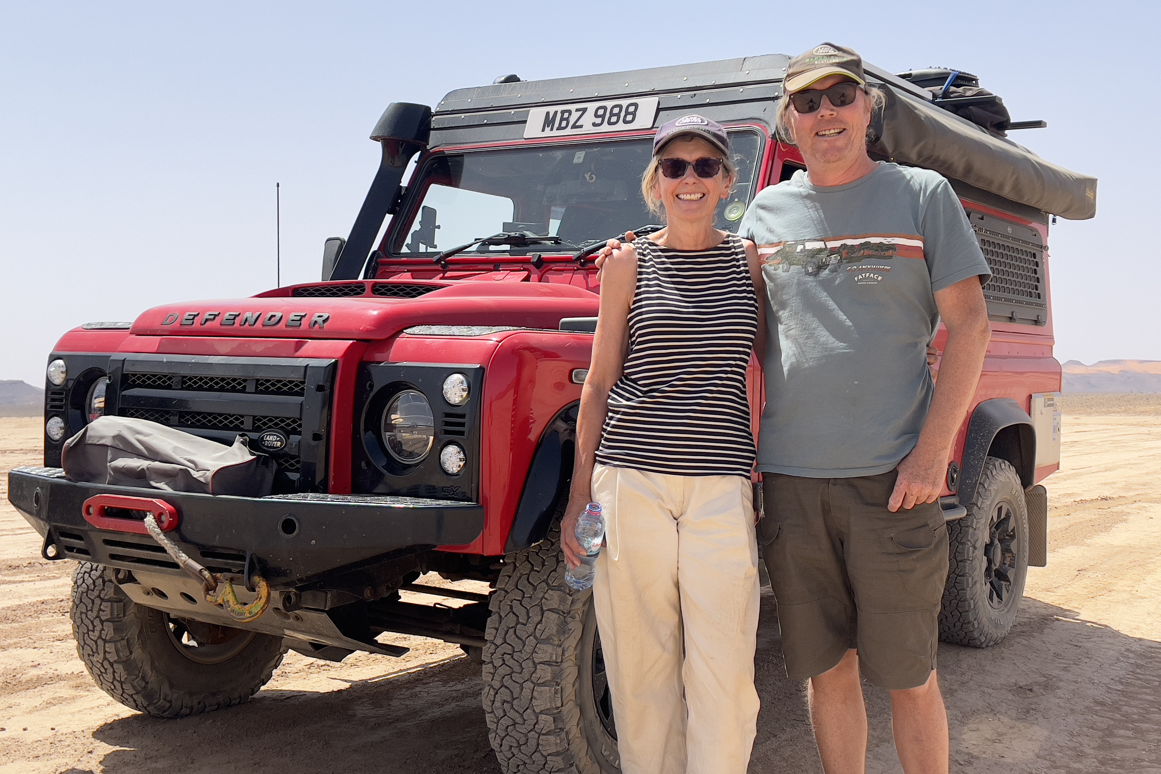
Mark, Deb, and I sat drinking cold beers from the refrigerator of the Landy well into the evening. They had just finished a guided trip with Mark White, of Amazigh Overland, who I also knew as he helped out with the TMT social media management. They were a friendly, welcoming couple, the conversation flowed easily from the trip they’d just done, to the juggling of a life of adventure with the responsibilities of a life back home and my own imminent plans to get married and start a family.
Like me, they were heading back towards Merzouga the next day, which lay some 120km as the crow flew across the desert. After breakfast in the morning, we exchanged WhatsApp numbers, as I bought the usual overpriced top up of petrol from a bottle, supplied by the owner of the bivouac.
Mark, Deb and I had traced the route towards Morocco’s perhaps most infamous (due to its reputation as a tourist trap) Saharan town, though without committing to go as a group. On the map, around two-thirds of the distance across, was The Lost City.
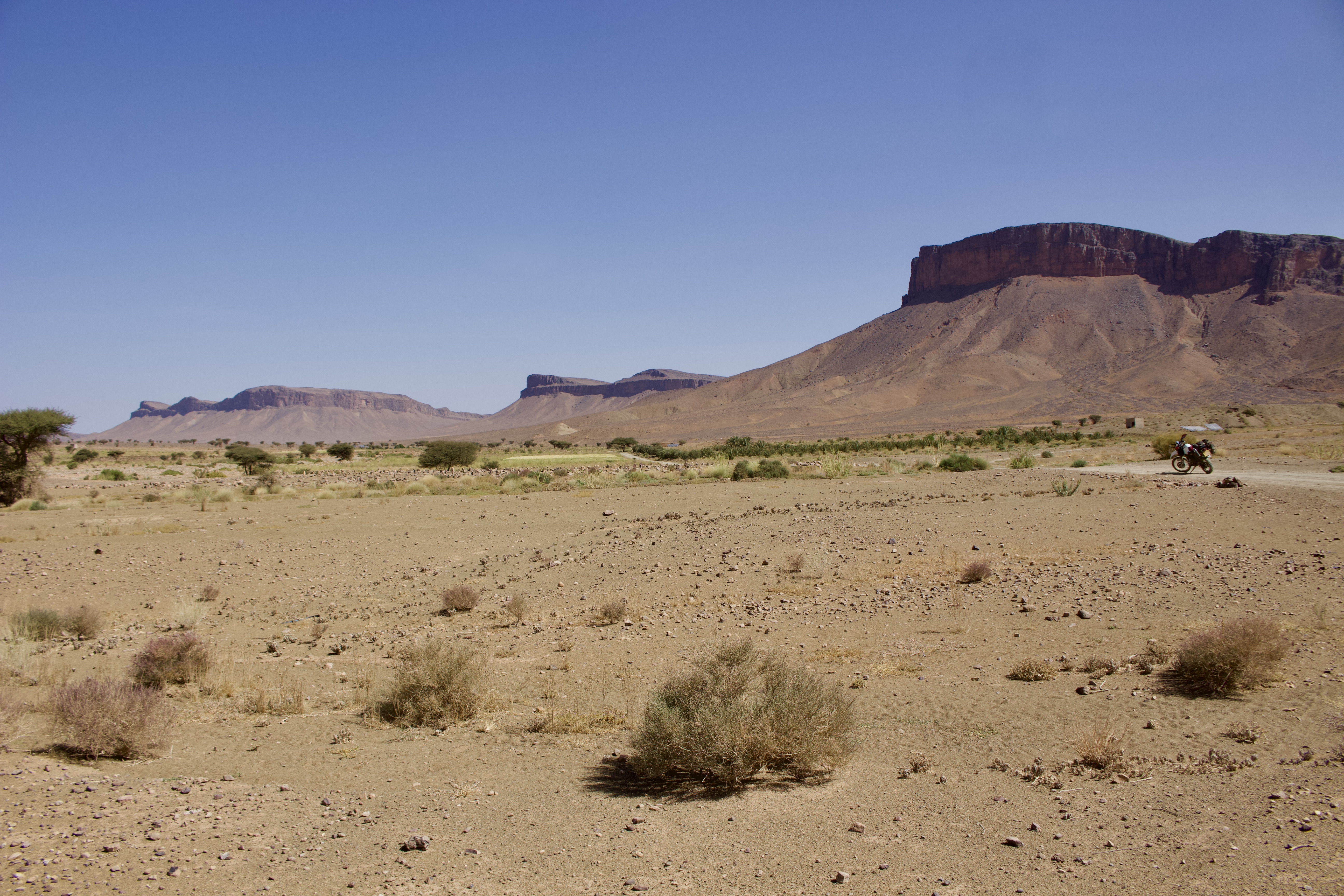
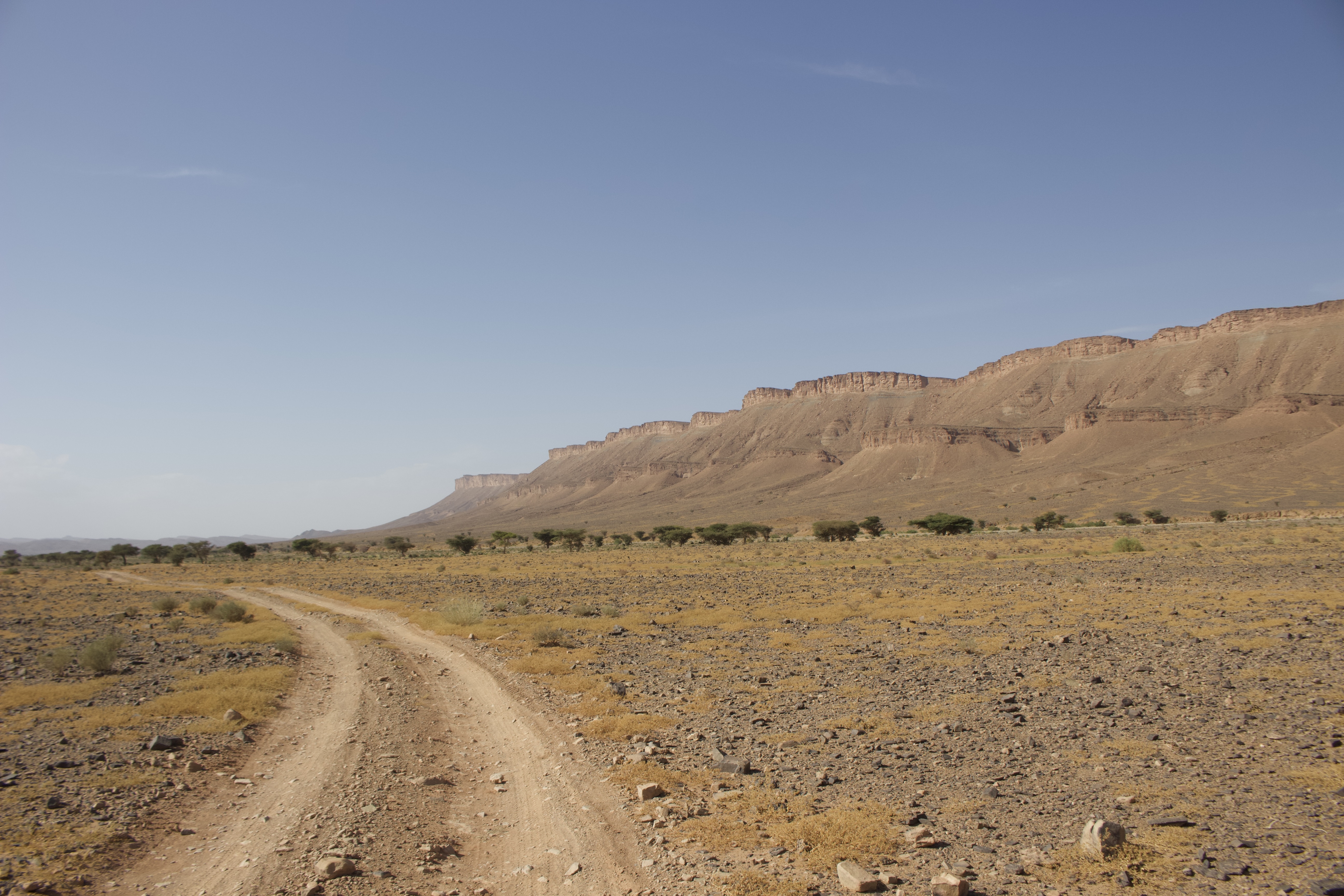
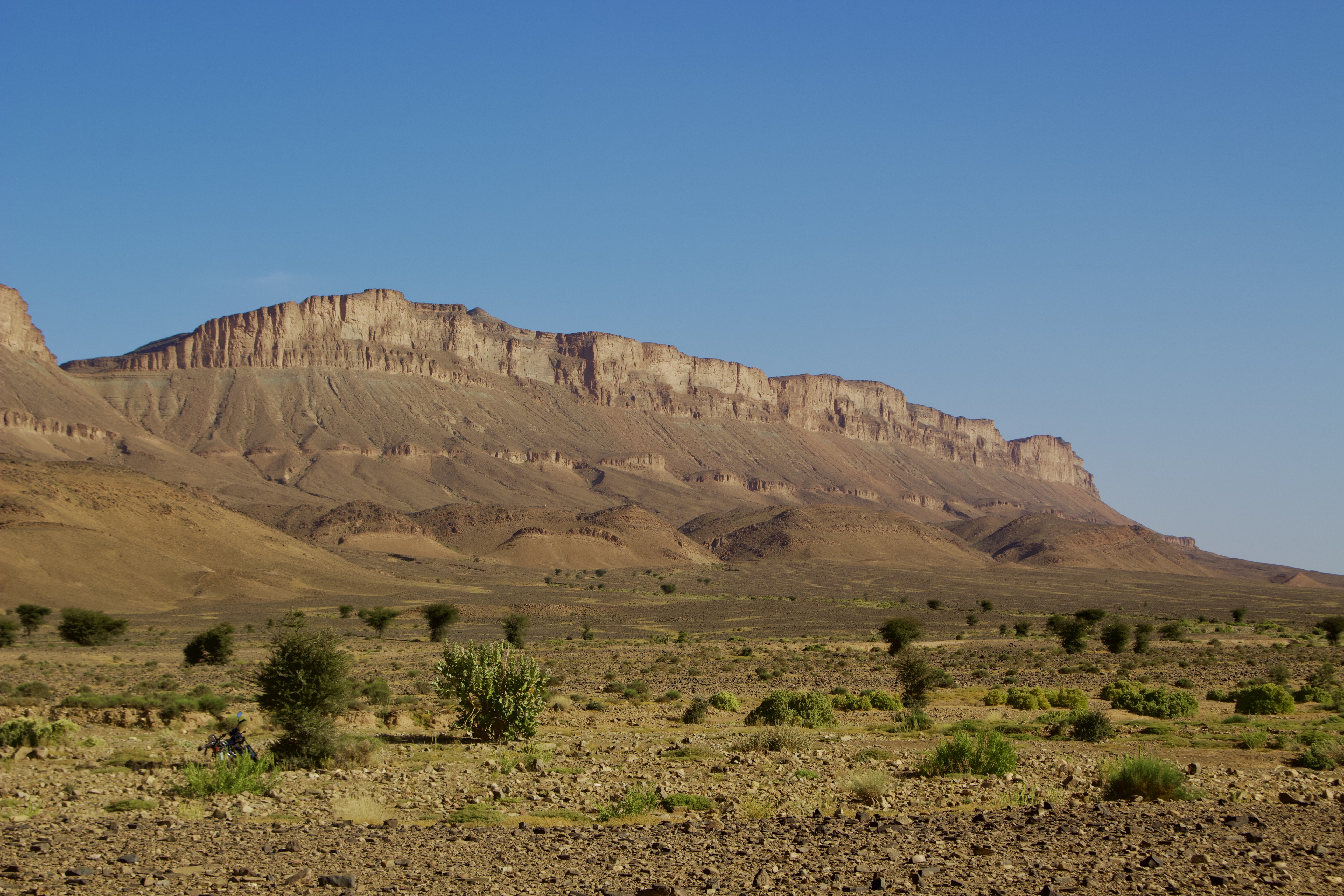
Despite me being up early, it was a lazy start. But by mid-morning I was finally on my way. A long, straight piste led straight east out of Fezzou, solid under the wheels with only patches of light sand, undulating up and down over gently rolling hills, with blue skies and big horizons all around. Soon I entered the expanse of a large dried up lake bed, its perimeter marked by the dusty silhouettes of the line of the low-lying Jbel Bani mountains, forming a wide, horizon-spanning natural barrier to the route ahead.
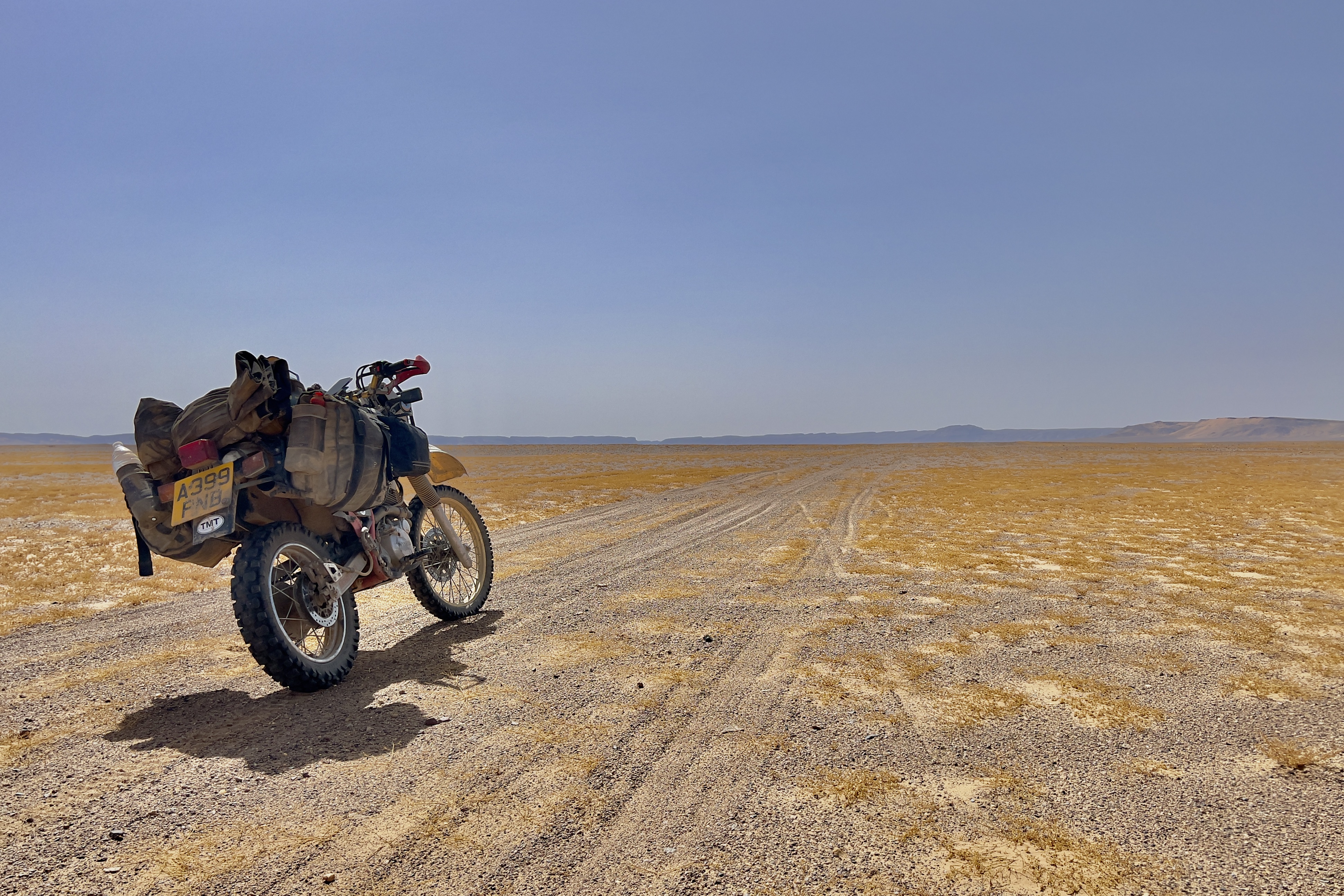
About 20km later, at a waypoint on the moving map in front of me, I swung the bike right, turning 90 degrees south. I opened up the throttle, enjoying the speed, freedom and space the lake provided, heading directly towards where I knew Camp El Mharech awaited me, at the centre of a gorge that marked the only route through the mountains, as the occasional 4×4 passed me coming in the other direction, presumably ferrying supplies or guests.
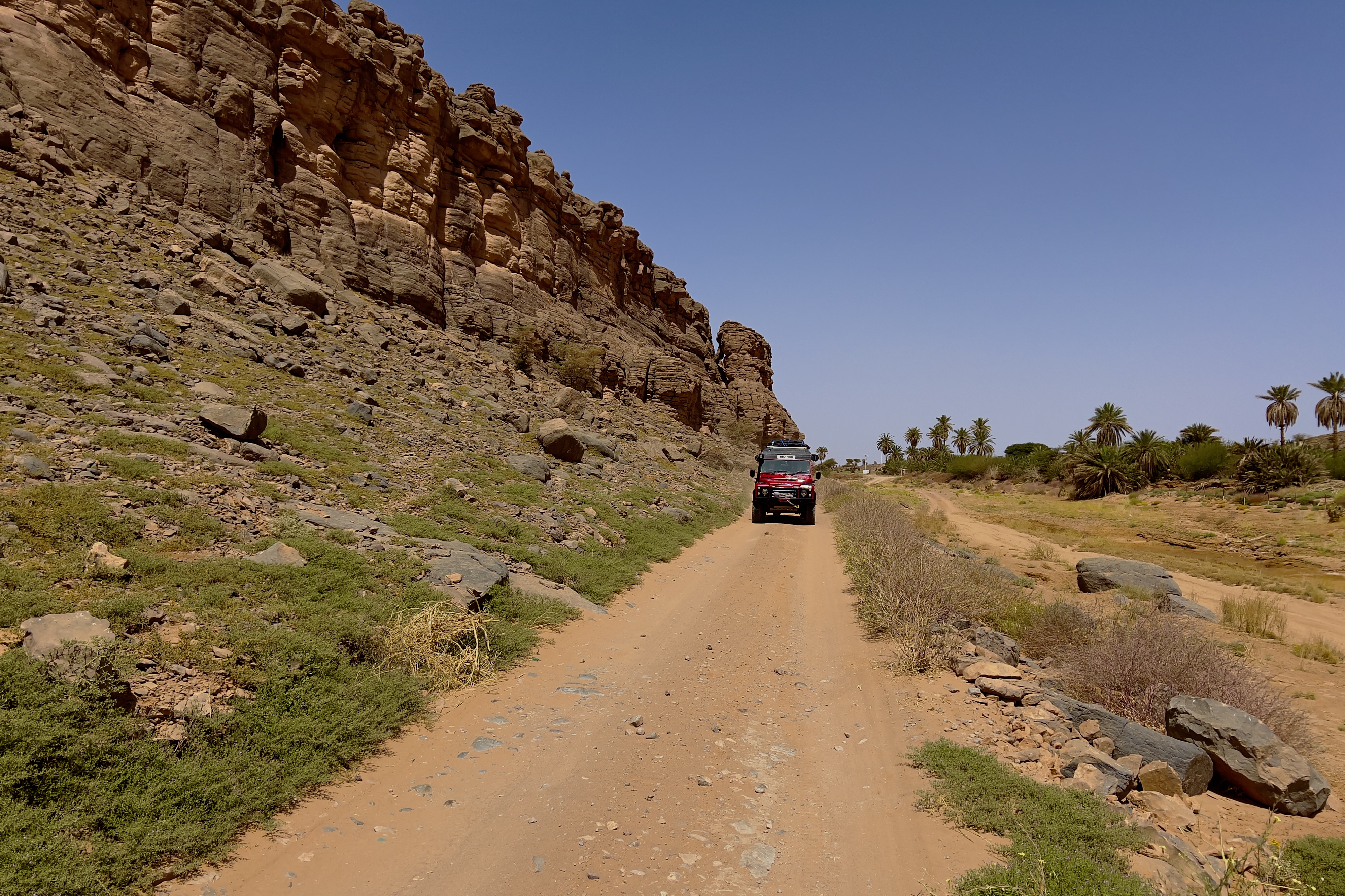
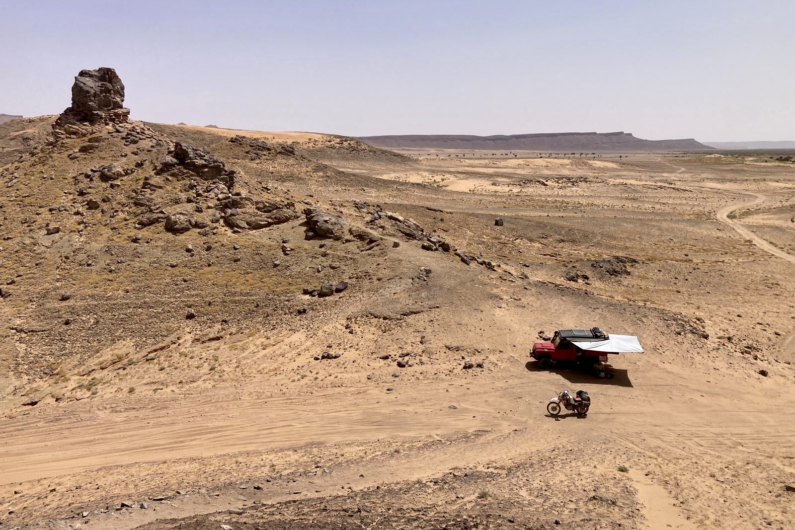
The final kilometre or so to the Camp did not pass without a fight, as the firm ground gave away to a sandy oued. In the mounting heat of the day, I wrestled with the bike and the deep tracks left by the 4x4s, out of breath and sweat beginning to drip down my face. Soon, I finally arrived at the terracotta-coloured walls that marked the perimeter of the Camp in the middle of an eponymous gorge, shaded by rows of green palm trees.
The Camp was actually a large kasbah-styled lodge with square buildings in a compound, made of rammed earth. It may have only been accesible via off-road vehicles, but, in the sign of the times, that didn’t stop it receiving a solid average of 4.6 out of 5 stars on Google Maps reviews from no less than 109 apparently satisfied customers.
Other than the Manager’s family of four sitting having a picnic in the shade of the trees, the Camp was otherwise deserted. I sat at a table outside, under the cover of a veranda with rows of Maghrebi arches, sinking three cans of ice cold Coca Cola back to back, as I chatted to him about the route ahead. The Manager’s wife sat on a blanket on the ground, as a young child toddled about, the grandparents looking on.
By midday, I was ready to move – I still had some 100km of unfamilar territory ahead of me, across the desert to Merzouga. The Manager, having warned me about the route, gave me his card with his mobile number on, should I need any help, despite the fact that the last mobile phone coverage was somewhere back near Fezzou and that it wasn’t likely to return any time soon.
As I made my way down the track at the bottom of the gorge away from the Camp, Mark and Deb’s bright red Land Rover appeared in my rear view mirror. As we hadn’t committed to travelling together, it was a pleasant surprise to see them – and to have some company, particularly given the Manager’s warnings. We chatted for a minute or two and decided to crack on towards The Lost City.
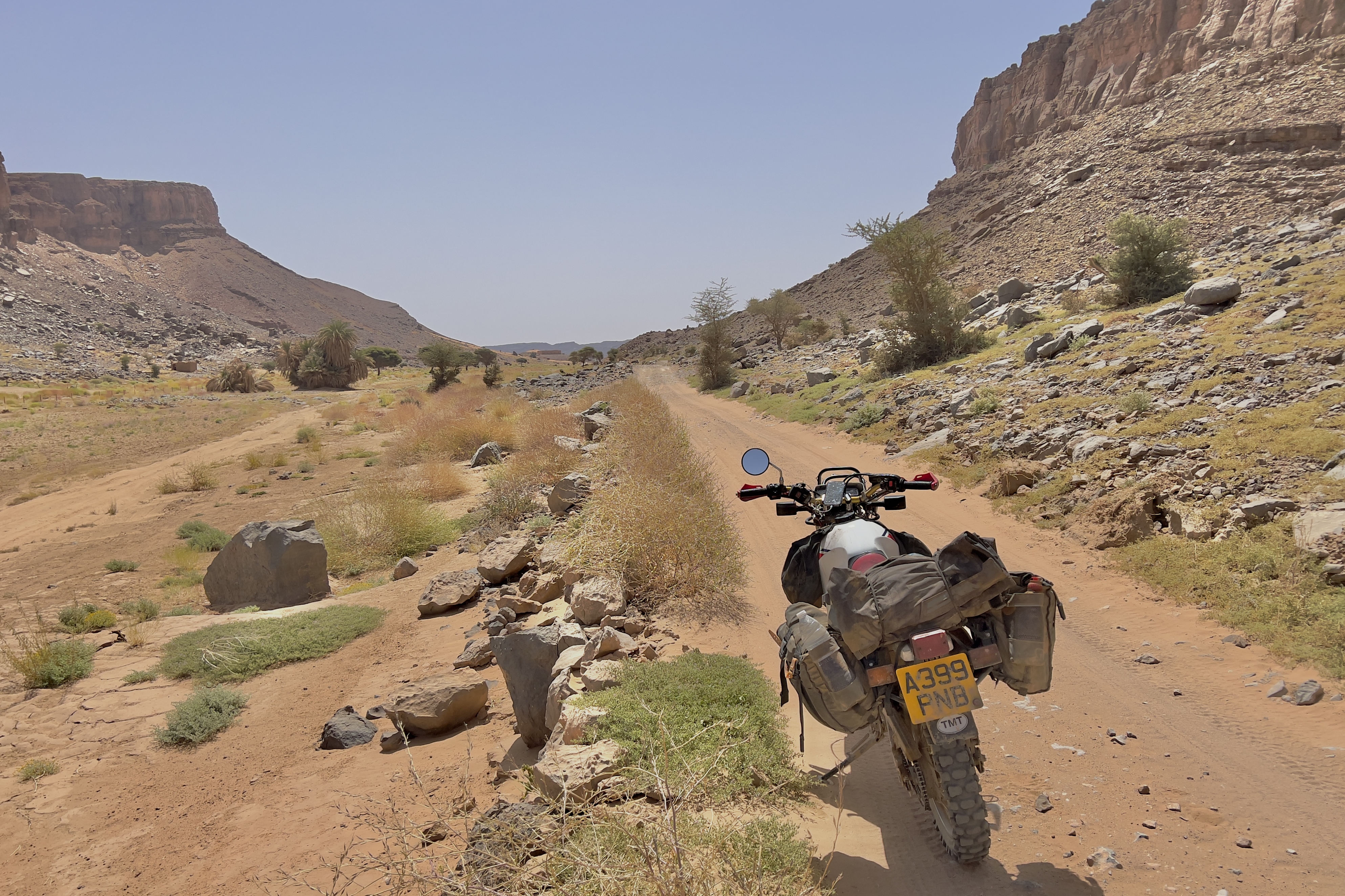
For the next few kilometres, I threaded the bike across a series of sandy tracks from the exit to the gorge, before eventually arriving at what appeared to be a second dried-up lakebed, stretching off into the distance. My hopes were raised that the Manager’s warnings were as unjustified, as I had suspected.
After another blast across the firm ground and light sand, we exited the dried up ground to a series of mini-sand dune ‘seas’, with expanses of small, interlocking dunes, which the tracks of preceding vehicles had weaved their way through. Our two vehicles soon became separated, with the Land Rover some way behind and then, perhaps a short while later, some way ahead.
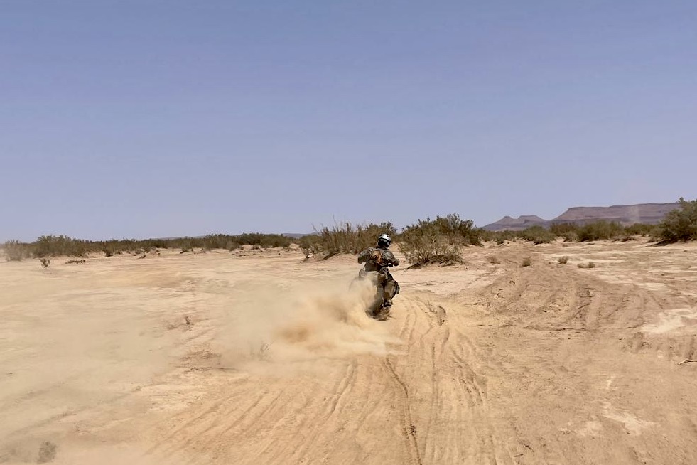
There were fast stretches, where the bike and I sailed over whatever ground lay however beneath the sand, and there were not-so-fast stretches, where I lost momentum and tried to get the critical mass of speed needed to surf over the soft surface, sinking lower as dust billowed out from beneath me.
Was this the mythical feche feche that the Manager had warned me about?
Maybe. Opinion amongst other desert travellers was divided as to whether there was any feche feche at all in Morocco; more experienced hands claimed that overexcited, less knowledgeable travellers, perhaps without the same understanding or skill level as them was at the heart of these claims, as they sought an explanation for their struggles in slippier, deeper sand.
Me? I didn’t know. And to be honest, I didn’t care. The online adventure travel community seemed rife with these kind of debates, and I personally found them maddening.
Whatever it was, it was there, and I needed to get across it.
Sweat poured down my face as time edged closer and closer to the warmest part of the day. I sucked more and more on the CamelPak loaded with a mixture of water and orange juice in my rucksack, wishing that alongside the usual medley of dried pasta and tomato sauce food supplies, I had also brought fizzy drinks and sugary Haribo to give me a boost.
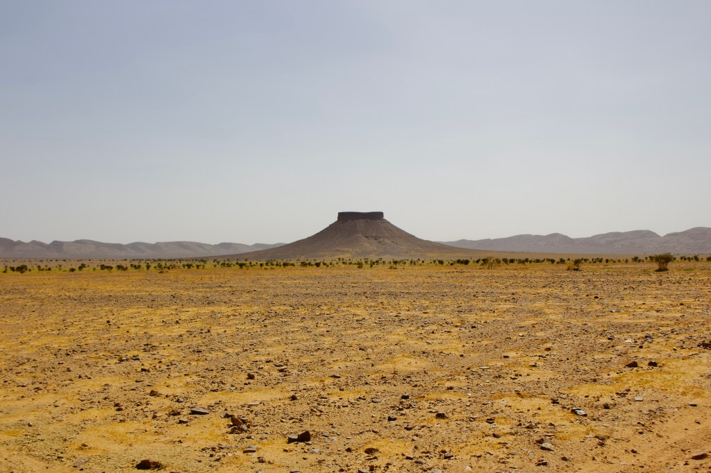
After about forty-five minutes, I finally emerged at a t-junction with a more travelled track running north to south, the clumps of green bushes signalling someplace, somewhere there was some kind of water. In the distance, a small hill eventually appeared on the horizon. I was almost at Ba Hallou.
The myth of Ba Hallou

If you look online, no one seems to really know for sure the back story of Ba Hallou. In fact, it’s fair to say there are no myths about the place, because there is just not much said about it all. The romantic and intriguing name it’s given on Google Maps is probably about as far as any mythology goes, likely the product of some entrepreneurial local guide’s marketing efforts to sex-up a long standing point of interest.
If that were true, then I certainly had fallen hook, line and sinker for it.
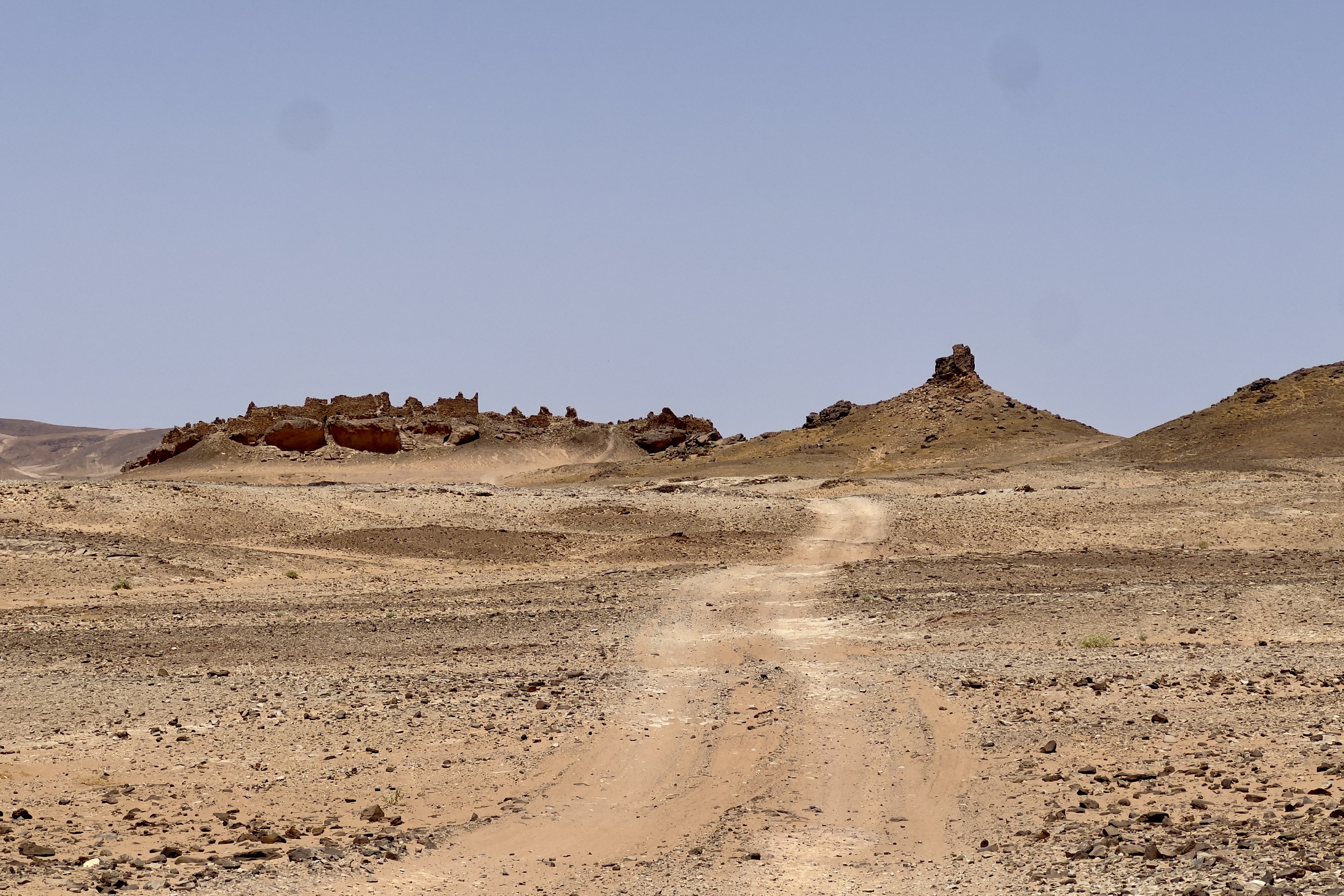
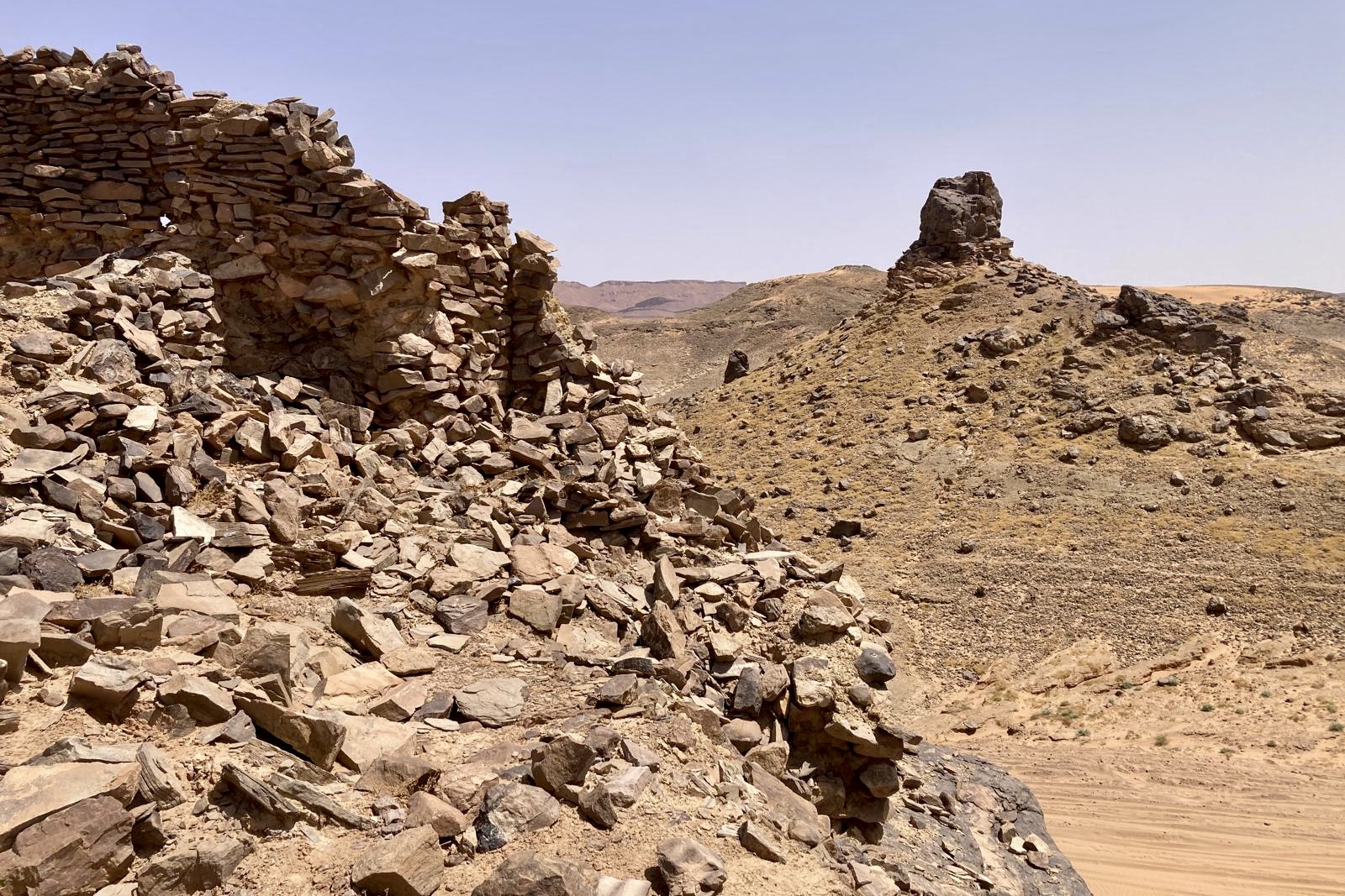
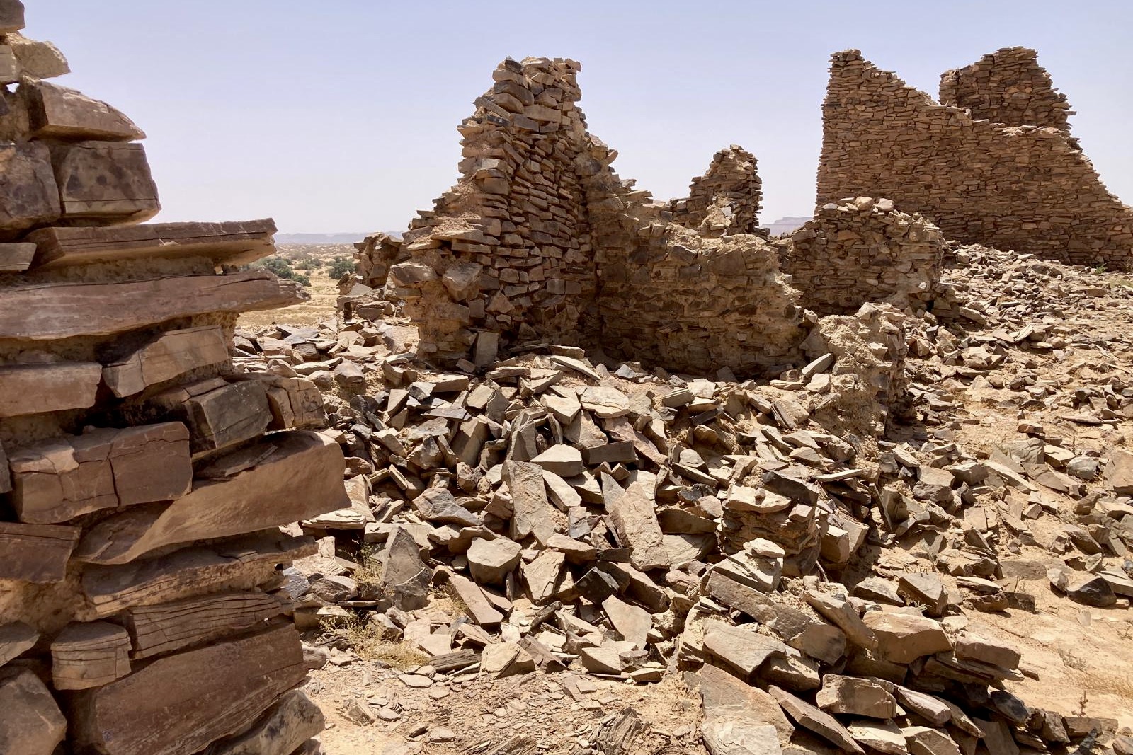
What is true is that, today, it’s a ghost ksour (fortified village) of ruined stone buildings perched on a rocky outcrop at the spot. The route that it lies on is probably one of the lesser travelled routes in the Moroccan Sahara, but nonetheless one which still gets its share of visitors each year, presumably from the more adventurous minded travellers or those who have hired a guide with a desire to offer something a little different then the more well-worn routes between Merzouga and Zagora, the twin capitals of Morocco’s desert tourism industry.
Before I left Zagora, I had tried to find out what I could about the place. And perhaps the most credible (only) explanation that I could find was on Reddit of all places, from a local guide:
“It was built during the reign of King Sebastião I of Portugal, probably around 1562 in the middle. The correct name is Ba Ba Hallou or Hasi Hallou and was built to protect the road to the oasis of Mharech. Its strategic location near the wide sandy river Oued M’birika and the surrounding mountains made it possible to control caravans and enemy tribes.”
Hasi means well (typically adjoined with the name of its owner – so in this case Hallou’s Well). Ba Hallou’s strategic location, on a main thoroughfare towards the oasis back at Foum Mharech (as the only easy way through the mountains that direction) made sense, both in terms of being a means of exerting control over the local area and trading routes, and acting as a stopping point for travellers. And it was on the route to Sijilmasa, near modern day Rissani some way to the north, an important trade terminal in the medieval Sahara where West African gold, having traversed the desert via caravan, was then minted into coins.
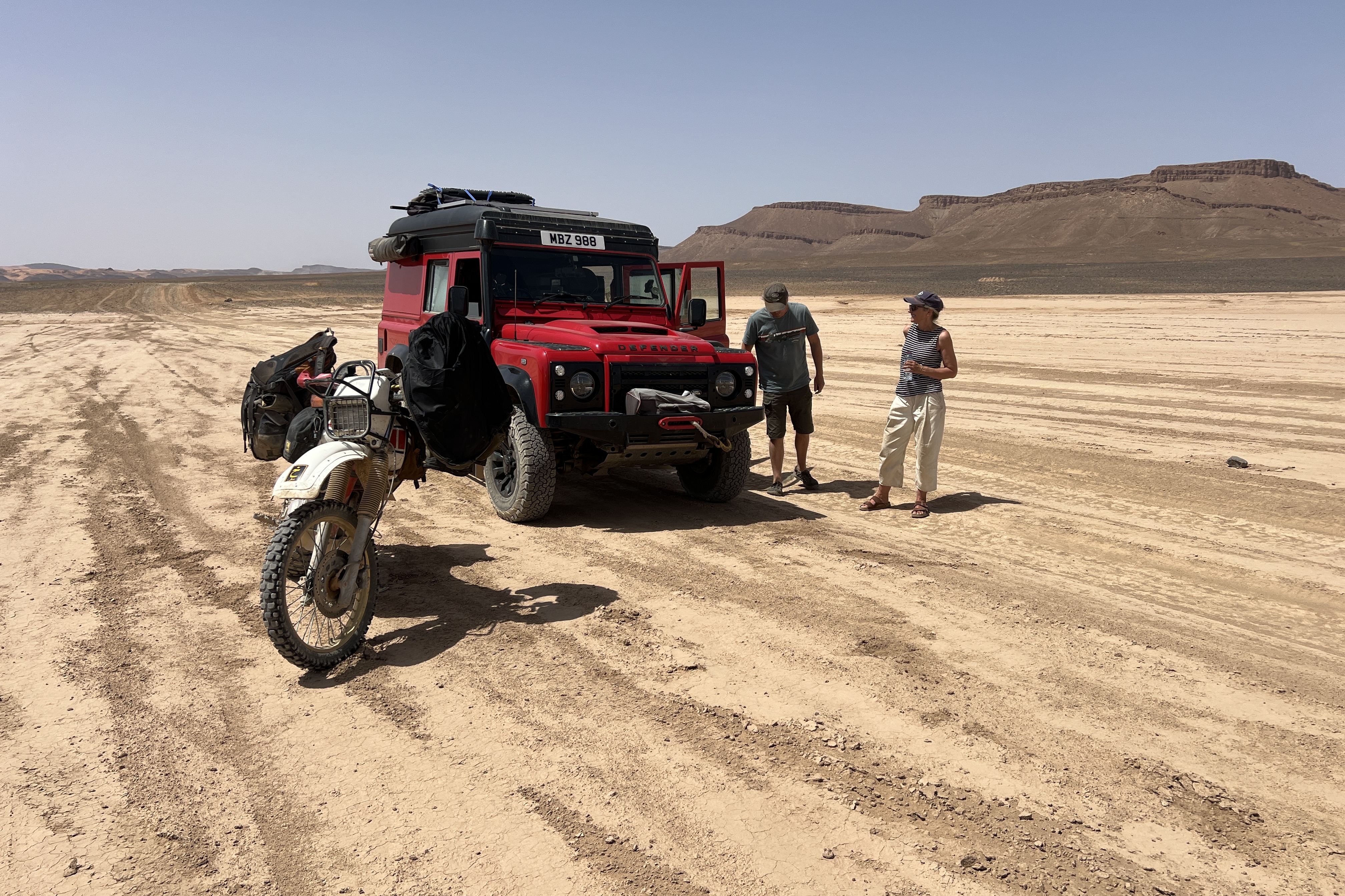
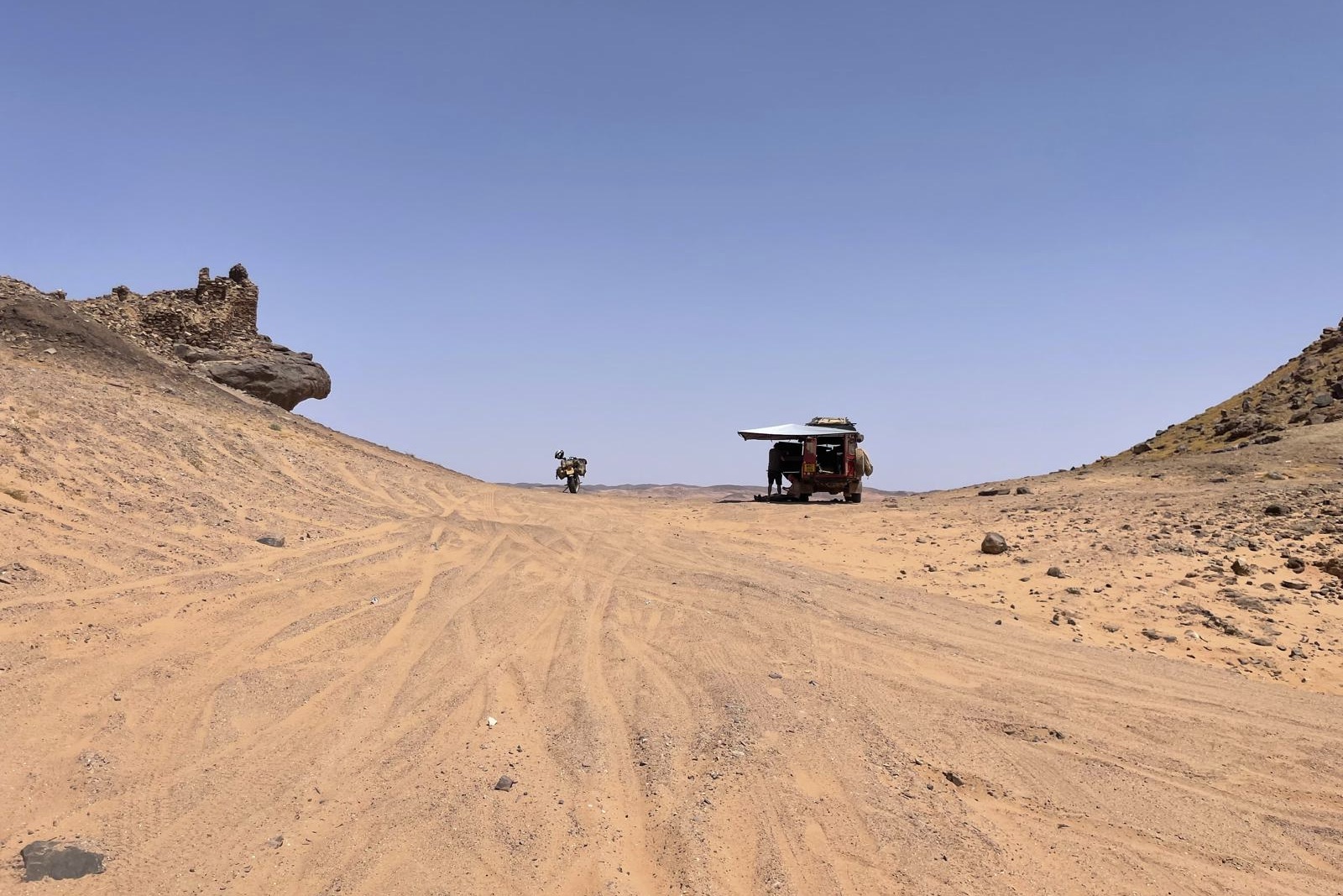
The Land Rover and I parked up at the base of the ruined ksour, and I counted my blessings as Mark and Deb not only opened up a sunshade from the top of the truck, but also offered me a cold drink from the onboard fridge. I munched through some now stale bread and tuna that I had bought the day before for lunch, before scrambling up to the ruins above.
It certainly was no Pompeii nor Herculaneum, and there might not have been much to see now other than the jumbled, dark brown stones that seemed to vaguely represent the outline of buildings, but as I looked back towards the way we came I realised I could see pretty much all the way back to Foum Mharech across the dunes and dried up lake beyond. That in itself was worth the effort to get there.
The final run to Merzouga
I had hoped for firmer ground and so quicker progress once we left Ba Hallou. After all, that would make sense, given the strategic location of the sentinel and that we were back on some of the main routes towards Merzouga. But the sandy sections continued, as we made our way over the dried up Oued Rheris, something it was notorious for to the south at Ramilia, where other pistes crossed it.
Slowly, and surely, the deeper sand sections petered out as the afternoon wore on and we headed further east. The Land Rover and I weaved our way on tracks across a flat landscape of familiar light sand and scrub, peppered with scrawny looking acacia trees and shattered basalt rock, sometimes driving together, other times separately. Deep brown, mesa-like rock formations that rose vertically out of the ground, standing proud and in sharp contrast to their surroundings.
Sometime in the last 40km or so, Mark and Deb and I became separated for the final time, as we picked our own ways eastwards. At around 4pm, the first bars of mobile phone reception began to return on the iPhone mounted on my handlebars. A short while later, I pulled the bike onto the tarmac of the main road that headed north to Merzouga, breathing a sigh of relief with a huge grin that I was through successfully. Hunger gnawed at my stomach. With firm ground beneath me, I relaxed back into the motorbike’s seat as I sped north on the smooth blacktop, unzipping my jacket all the way down with my left hand as the right held the throttle open, allowing the air in to cool me down.
I’d wanted a bit of an adventure, probably the last one of this trip at least. The Lost City of Ba Hallou, whatever the truth of its history, had given me that.
